- Pomme de Terre River (Minnesota)
- Geobox River
name = Pomme de Terre River
native_name =
other_name =
other_name1 =
image_size = 290
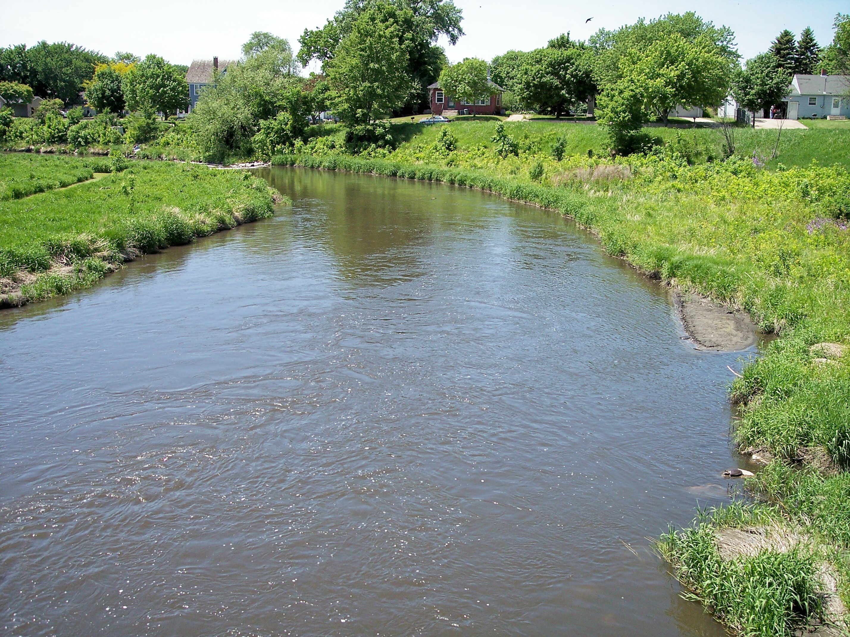
image_caption = The Pomme de Terre River in Appleton in 2007
country = United States
state = Minnesota
region =
region1 =
district =
district1 =
city =
city1 =
length_imperial = 105.9
length_note = cite web |url= http://mrbdc.mnsu.edu/major/pdterre/desc23.html |title= Pomme de Terre River Major Watershed. |pages= [http://mrbdc.mnsu.edu/major/pdterre/descstream23.html Streams within the Pomme de Terre River Major Watershed] |publisher= Minnesota River Basin Data Center.Minnesota State University, Mankato |date= 2000-06-06 |accessdate= 2007-06-14]
watershed_imperial = 875
watershed_note = [cite web |url= http://mrbdc.mnsu.edu/major/pdterre/desc23.html |title= Pomme de Terre River Major Watershed. |pages= [http://mrbdc.mnsu.edu/major/pdterre/descgen23.html General Description] |publisher= Minnesota River Basin Data Center.Minnesota State University, Mankato |date= 2000-06-06 |accessdate= 2007-06-14]
discharge_location = Appleton
discharge_imperial = 132
discharge_max_imperial = 8890
discharge_min_imperial = 0
discharge_note = cite web |url=http://pubs.usgs.gov/wdr/2005/wdr-mn-05-1/ |pages = [http://pubs.usgs.gov/wdr/2005/wdr-mn-05-1/05294000.2005.sw.pdf Pomme de Terre River at Appleton, MN] |title=Water Resources Data in Minnesota, Water Year 2005 Annual Report. |first= G. B. |last=Mitton |coauthors=K. G. Guttormson, G. W. Stratton, E. S. Wakeman |publisher=United States Geological Survey |accessdate=2007-06-14]
discharge1_location =
discharge1_imperial =
source_name =Stalker Lake
source_location = Tordenskjold Township
source_district = Otter Tail County
source_region =
source_lat_d = 46
source_lat_m = 11
source_lat_s = 55
source_lat_NS = N
source_long_d = 95
source_long_m = 51
source_long_s = 20
source_long_EW = W
source_coordinates_note = cite web |url=Gnis3|649622 |title=Geographic Names Information System entry for Pomme de Terre River (Feature ID #649622) |publisher=Geographic Names Information System |accessdate=2007-06-14]
source_elevation_imperial = 1283
source_elevation_note =Google Earth elevation forGNIS coordinates. Retrieved on2007-06-14 .]
mouth_name = Minnesota River
mouth_location = Appleton Township
mouth_district = Swift County
mouth_region =
mouth_lat_d = 45
mouth_lat_m = 10
mouth_lat_s = 33
mouth_lat_NS = N
mouth_long_d = 96
mouth_long_m = 05
mouth_long_s = 13
mouth_long_EW = W
mouth_coordinates_note =
mouth_elevation_imperial = 935
mouth_elevation_note =
tributary_left =
tributary_left1 =
tributary_right =
tributary_right1 =
free_name =
free_value =

map_size =
map_caption =The Pomme de Terre River is a
tributary of theMinnesota River , 106 miles (170 km) long, in westernMinnesota in theUnited States . Via the Minnesota River, it is part of the watershed of theMississippi River , draining an area of 875 square miles (2,266 km²) in an agricultural region. The headwaters region of the Pomme de Terre River is the northernmost extremity of the Minnesota River's watershed. [cite web |url= http://www.pca.state.mn.us/water/basins/mnriver/watersheds.html |title= Watersheds of the Minnesota River Basin. | publisher= Minnesota Pollution Control Agency |date= 2005-12-01 |accessdate= 2007-06-14]"Pomme de terre" is French for
potato ; the river was named by early French explorers for a differentroot vegetable , the potato-like prairie turnip, which was commonly eaten by theSioux . [cite web |url=http://mnplaces.mnhs.org/upham/index.cfm |title=Minnesota Place Names: A Geographical Encyclopedia. |accessdate=2007-06-19 |last=Upham |first=Warren |publisher=Minnesota Historical Society |pages= [http://mnplaces.mnhs.org/upham/waterway.cfm?PlaceNameID=2441&BookCodeID=53&County=26&SendingPage=Results.cfm Grant County: Pomme de Terre Township] ] cite book| last= Waters |first= Thomas F. | title= The Streams and Rivers of Minnesota |year= 2006 |publisher=University of Minnesota Press |location=Minneapolis |isbn= 0-8166-0960-8 |pages= pp. 304-323 |chapter= The Minnesota: Corridor West] [cite web |url= http://mrbdc.mnsu.edu/mnbasin/mnbasin_overview.html |title= Basin Overview. |pages= [http://mrbdc.mnsu.edu/mnbasin/fact_sheets/pn_pdt.html Place Names: Pomme de Terre] |publisher= Minnesota River Basin Data Center.Minnesota State University, Mankato |date= 2004-11-15 |accessdate= 2007-06-19]Geography
The Pomme de Terre River issues from Stalker Lake in Tordenskjold Township, approximately three miles (5 km) northeast of Dalton in southern Otter Tail County, and flows generally southwardly through eastern Grant and Stevens Counties and western Swift County, through the cities of Barrett, Morris, and Appleton. It flows into Marsh Lake on the Minnesota River in southwestern Swift County, approximately four miles (6 km) southwest of Appleton. Marsh Lake was formed by a backup of water caused by the Pomme de Terre's delta, and is presently maintained by a manmade dam.cite book| title= Minnesota Atlas & Gazetteer |year=1994 |publisher=
DeLorme |location=Yarmouth, Me. |isbn= 0-89933-222-6 |pages= pp. 36, 43-44, 51-52]In its upper course the river flows through a morainic region of numerous lakes, in a course characterized by meadows and wooded hills, as well as
marsh y stretches near areas where the river passes through lakes. The largest lakes on the river include Ten Mile Lake in Otter Tail County; Pomme de Terre and Barrett Lakes in Grant County; and Perkins Lake in Stevens County. The water levels of several lakes on the river's course are maintained by small dams. Downstream of Morris, the river flows ontill plain s between eroding banks and becomes increasingly turbid. According to the Minnesota Pollution Control Agency, approximately 81% of the land in the Pomme de Terre River's watershed is used for agriculture; of this area, half is used for the cultivation of corn andsoybean s, and 43% for that ofhay and small grains. [cite web |url= http://www.pca.state.mn.us/water/basins/mnriver/watersheds.html |title= Watersheds of the Minnesota River Basin. |pages= [http://www.pca.state.mn.us/water/basins/mnriver/watershed-pommdeterre.pdf Minnesota River Basin: Pomme de Terre River Watershed] |publisher= Minnesota Pollution Control Agency |date= 2005-12-01 |accessdate= 2007-06-14]Flow rate
At the
United States Geological Survey 'sstream gauge in Appleton, eight miles (13 km) upstream from the river's mouth, the annual mean flow of the river between 1931 and 2005 was 132cubic feet per second (4 m³/s). The highest recorded flow during the period, resulting in part from adam failure, was 8,890 ft³/s (252 m³/s) onApril 7 ,1997 . Readings of zero were recorded on numerous days during several years.ee also
*
List of rivers in Minnesota References
External links
* [http://waterdata.usgs.gov/nwis/uv?05294000 Real-Time Water Data for Pomme de Terre River at Appleton]
Wikimedia Foundation. 2010.