- Nuthetal
-
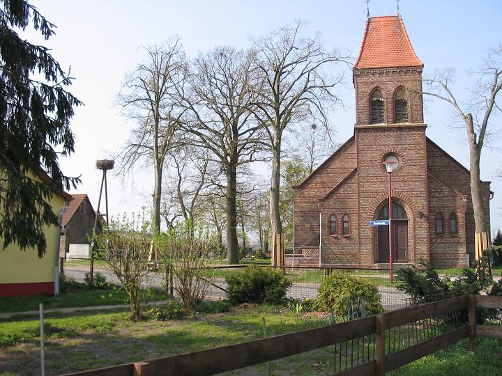
Nuthetal Church in the village of Fahlhorst and nest of stork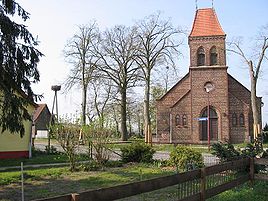

 NuthetalLocation of Nuthetal within Potsdam-Mittelmark district
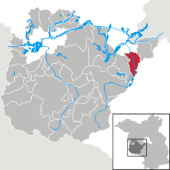
Coordinates 52°21′0″N 13°05′59″E / 52.35°N 13.09972°ECoordinates: 52°21′0″N 13°05′59″E / 52.35°N 13.09972°E Administration Country Germany State Brandenburg District Potsdam-Mittelmark Local subdivisions 6 parts of municipalities Mayor Ute Hustig (Die Linke) Basic statistics Area 47.56 km2 (18.36 sq mi) Elevation 34 m (112 ft) Population 8,778 (31 December 2010)[1] - Density 185 /km2 (478 /sq mi) Other information Time zone CET/CEST (UTC+1/+2) Licence plate PM Postal code 14558 Area code 033200 Website www.nuthetal.de Nuthetal is a municipality in the Potsdam-Mittelmark district, in Brandenburg, Germany.
Contents
Geography
Nuthetal is situated south-west of Berlin. The area was formed from a series of large moraines during the last ice age. The municipality originated in October 2003 from the voluntary union of the independent municipalities Bergholz-Rehbrücke, Fahlhorst, Nudow, Philippsthal, Saarmund and Tremsdorf. The municipality owes its name to the rivulet Nuthe which flows between the places situated to the west Bergholz-Rehbrücke, Saarmund and Tremsdorf and the villages Nudow and Philippsthal situated to the east and flows into Havel in Potsdam.
Parts of the municipality
- Bergholz-Rehbrücke (5.600 Inhabitants)
- Fahlhorst (120 I.)
- Nudow (450 I.)
- Philippsthal (190 I.)
- Saarmund (1.450 I.)
- Tremsdorf (200 I.)
Honorary citizen
The only honorary citizen buried here in Bergholz-Rehbrücke is the actress, singer and revue artiste Lotte Werkmeister.
References
- ^ "Bevölkerung im Land Brandenburg am am 30. Dezember 2010 nach amtsfreien Gemeinden, Ämtern und Gemeinden. Gebietsstand: 31.12.2010" (in German). Amt für Statistik Berlin-Brandenburg. 31 December 2010. http://www.statistik-berlin-brandenburg.de//Publikationen/OTab/2011/OT_A01-04-00_124_201012_BB.pdf.
External links
- official web-site of the municipality Nuthetal (German language)
Bad Belzig | Beelitz | Beetzsee | Beetzseeheide | Bensdorf | Borkheide | Borkwalde | Brück | Buckautal | Golzow | Görzke | Gräben | Groß Kreutz | Havelsee | Kleinmachnow | Kloster Lehnin | Linthe | Michendorf | Mühlenfließ | Niemegk | Nuthetal | Päwesin | Planebruch | Planetal | Rabenstein | Rosenau | Roskow | Schwielowsee | Seddiner See | Stahnsdorf | Teltow | Treuenbrietzen | Wenzlow | Werder | Wiesenburg | Wollin | Wusterwitz | Ziesar Categories:
- Municipalities in Brandenburg
- Localities in Potsdam-Mittelmark


Wikimedia Foundation. 2010.