Musa Khel, Khost Province
- Musa Khel, Khost Province
-
Categories: - Populated places in Khost Province
- Afghanistan geography stubs
Wikimedia Foundation.
2010.
Look at other dictionaries:
Musa Khel District — This article is about the district in Afghanistan. For the district in Pakistan, see Musakhel District. Musa Khel District is situated in the northern part of the Khost Province, Afghanistan. It borders with Paktia Province to the north, Sabari… … Wikipedia
Khôst (province) — 33° 24′ N 69° 54′ E / 33.4, 69.9 … Wikipédia en Français
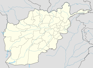
Khost Province — Geobox|Province country = Afghanistan country name = Khost native name = خوست map caption = Map of Afghanistan with Khost highlighted capital = Khost capital lat d = 33.4 capital long d = 69.9 population as of = 2002 population = 300,000 area =… … Wikipedia
Khost (Provinz) — DMS … Deutsch Wikipedia
Khost (Matun) District — is situated in the central and eastern part of Khost Province, Afghanistan. It borders with Mandozi and Nadir Shah Kot districts to the West, Musa Khel District to the North West, Sabari District to the North, Tere Zayi District to the North and… … Wikipedia
Musa Qala District — US Forward Operating Base Little Round Top, Musa Qala District Musa Qala is a district in the north of Helmand Province, Afghanistan.[1] Its population, which is 97% Pashtun, was 50,300 in 2005. The district centre is the village of Musa Qala; … Wikipedia
Sar-e Pol Province — Coordinates: 35°36′N 66°18′E / 35.6°N 66.3°E / 35.6; 66.3 … Wikipedia
Wardak Province — Coordinates: 34°24′N 68°24′E / 34.4°N 68.4°E / 34.4; 68.4 … Wikipedia
Nangarhar Province — Coordinates: 34°15′N 70°30′E / 34.25°N 70.50°E / 34.25; 70.50 … Wikipedia
Nimruz Province — Coordinates: 31°00′N 62°30′E / 31.0°N 62.5°E / 31.0; 62.5 … Wikipedia
 Musa Khel
 Afghanistan