- Kirkhill, Nova Scotia
Infobox Settlement
official_name = Pagename
other_name =
native_name =
nickname =
settlement_type = Village
motto =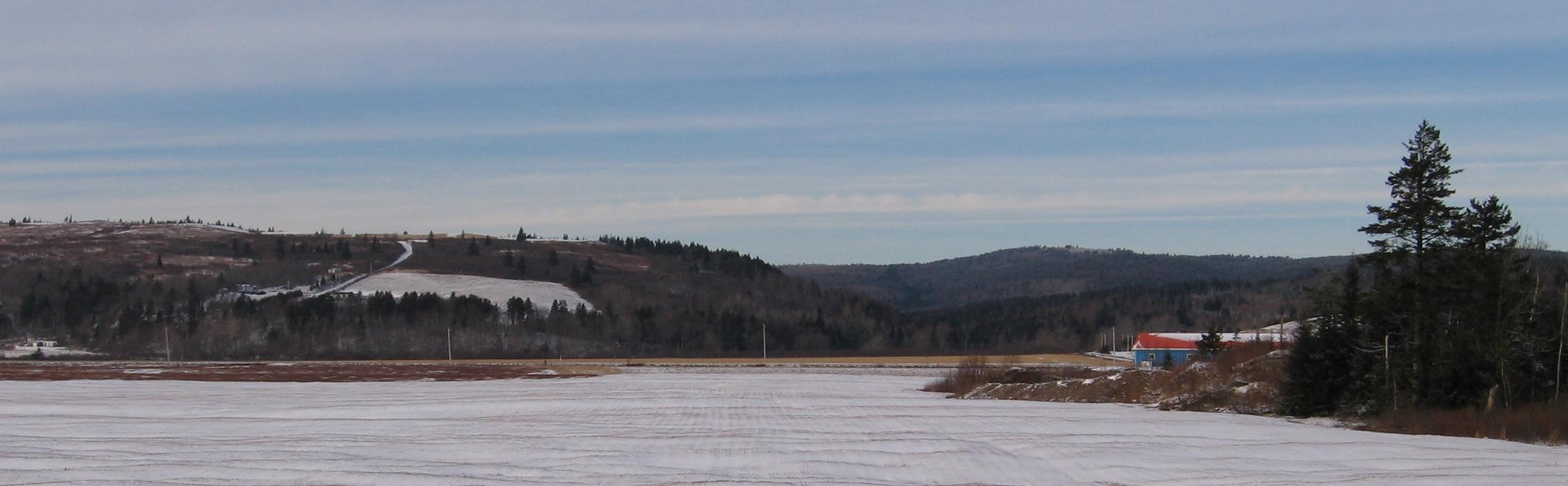
imagesize =
image_caption = Kirkhill from Parrsboro in January 2006.
flag_size =
image_
seal_size =
image_shield =
shield_size =
city_logo =
citylogo_size =
mapsize =
map_caption =
mapsize1 =
map_caption1 =
image_dot_
dot_mapsize = 250px
dot_map_caption =Location of Pagename
dot_x =71 |dot_y =78
pushpin_
pushpin_label_position =
pushpin_map_caption =
pushpin_mapsize =
subdivision_type = Country
subdivision_name = CAN
subdivision_type1 = Province
subdivision_name1 = NS
subdivision_type2 = Municipality
subdivision_name2 = Cumberland County
subdivision_type3 =
subdivision_name3 =
subdivision_type4 =
subdivision_name4 =
government_footnotes =
government_type =
leader_title =
leader_name =
leader_title1 =
leader_name1 =
leader_title2 =
leader_name2 =
leader_title3 =
leader_name3 =
leader_title4 =
leader_name4 =
established_title =
established_date =
established_title2 =
established_date2 =
established_title3 =
established_date3 =
area_magnitude =
unit_pref =
area_footnotes =
area_total_km2 =
area_land_km2 =
area_water_km2 =
area_total_sq_mi =
area_land_sq_mi =
area_water_sq_mi =
area_water_percent =
area_urban_km2 =
area_urban_sq_mi =
area_metro_km2 =
area_metro_sq_mi =
population_as_of =
population_footnotes =
population_note =
population_total =
population_density_km2 =
population_density_sq_mi =
population_metro =
population_density_metro_km2 =
population_density_metro_sq_mi =
population_urban =
population_density_urban_km2 =
population_density_urban_sq_mi =
population_blank1_title =
population_blank1 =
population_density_blank1_km2 =
population_density_blank1_sq_mi =
timezone = AST
utc_offset = -4
timezone_DST =
utc_offset_DST =
latd=45 |latm=25 |lats= |latNS=N
longd=64 |longm=21|longs= |longEW=W
elevation_footnotes =
elevation_m =
elevation_ft =
postal_code_type = Postal code
postal_code = B
area_code = 902
blank_name =Telephone Exchange
blank_info =254
blank1_name =
blank1_info =
website =
footnotes =
Kirkhill is a rural community in Cumberland County,Part of a series about Places in Nova Scotia Nova Scotia , northwest of Parrsboro on Route 209. It is reputed that the town's name derives from settler James Kirkpatrick, who settled on "Kirk's Hill" in 1812. [cite web | url = http://www.gov.ns.ca/nsarm/cap/places/page.asp?ID=334 | title = Public Archives of Nova Scotia C@P Site - Place-Names and Places of Nova Scotia| accessdate = 2007-10-03] A road equipment garage of the Nova Scotia Department of Transportation is located in Kirkhill.Geographic Location (8-way)
Centre = Pagename
North =
Northeast =
References

Wikimedia Foundation. 2010.