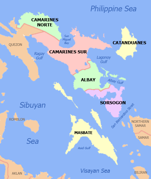
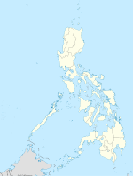
Masbate — redirects here. For other uses, see Masbate (disambiguation). Masbate Province … Wikipedia
Masbate (disambiguation) — Masbate may refer to: Masbate City Masbate Province Masbate Island Masbate Airport This disambiguation page lists articles associated with the same title. If an internal link led you here … Wikipedia
Masbate — [mäs bä′tē] island of the EC Philippines, west of Samar: 1,262 sq mi (3,269 sq km) … English World dictionary
Masbate City — City of Masbate Ciudad nin Masbate Dakbayan sa Masbate Lungsod ng Masbate Nickname(s): City of Hearts, The Rodeo Capital of the Philippines, The Melting Pot of Diverse Cultures and Traditions in Central Philippines Motto: Aksyon Padayon! … Wikipedia
Masbate — /mahs bah teuh/, n. 1. one of the central islands of the Philippines. 584,520; 1262 sq. mi. (3269 sq. km). 2. a city on this island. 52,944. * * * Island (pop. 2000: 707,668) of the Visayan group, central Philippines. The V shaped island occupies … Universalium
Island groups of the Philippines — The Philippines is divided into three island groups of Luzon, Visayas and Mindanao. Luzon and Mindanao are named after their main islands of the same names, while the Visayas (the Visayan Islands) is an archipelago. Divisions The different… … Wikipedia
Masbate — geographical name island central Philippines in the Visayans NE of Panay area 1571 square miles (4085 square kilometers) … New Collegiate Dictionary
Masbate — /mahs bah teuh/, n. 1. one of the central islands of the Philippines. 584,520; 1262 sq. mi. (3269 sq. km). 2. a city on this island. 52,944 … Useful english dictionary
Cataingan, Masbate — Cataingan is a 3rd class municipality in the province of Masbate, Philippines. According to the 2000 census, it has a population of 46,593 people in 9,310 households. Cataingan is one of the municipalities and cities of Masbate where Cebuano is… … Wikipedia
Ticao Island — This article is for the island in the Philippines. For the body of water, please see Ticao Pass. Ticao Island is one of the three major islands of Masbate Province in the Philippines. The other two major Islands are Masbate Island and Burias… … Wikipedia

 Masbate (island) (Philippines)