- Dizin
-
Dizin
دیزین
Dizin ski resortLocation Tehran, Iran Coordinates 36°02′57″N 51°25′02″E / 36.04917°N 51.41722°E Top elevation 3600m Base elevation 2650m Skiable area 469ha Runs 23 Lift system 3 gondola
12 chairliftsSnowmaking ?% Night skiing No Web site DizinPad.com Dizin is a ski resort situated to the north of Tehran in the Alborz mountain range.
The huge Dizin ski resort was established in 1969 [1]. The ski season in Dizin also lasts longer than European ski resorts(from December to May) because of its high altitude.
The highest ski lift reaches 3,600 m (11,800 ft), making it one of the 40 highest ski resorts in the world.
Dizin ski amenities include two hotels, 19 cottages and five restaurants, villas and private apartments around the Dizin ski resort accommodate thousands of people every year.
Contents
Location
Map of central Alborz Peaks: 1 `Alam Kūh 
 -25 to 500 m500 to 1500 m1500 to 2500 m2500 to 3500 m3500 to 4500 m4500 to 5671 m
2 Āzād Kūh 3 Damāvand 4 Do Berar 5 Do Khaharan 6 Ghal`eh Gardan 7 Gorg 8 Kholeno 9 Mehr Chal 10 Mīšīneh Marg 11 Naz 12 Shah Alborz 13 Sīālān 14 Tochal 15 Varavašt Rivers: 0 1 Alamūt 2 Chālūs 3 Do Hezār 4 Harāz 5 Jājrūd 6 Karaj 7 Kojūr 8 Lār 9 Nūr 10 Sardāb 11 Seh Hazār 12 Shāh Rūd Cities: 1 Āmol 2 Chālūs 3 Karaj Other: D Dīzīn E Emāmzādeh Hāšem K Kandovān Tunnel * Latīān Dam ** Lār Dam The Dizin ski complex is the first ski and winter sport resort in Iran which has been officially recognized and granted the title by the International Ski Federation for its capability in administrating official and international competitions.[1]
It gained its official title for its specific physical and technical features such as the course slope, length of the course and the place where the competitions and races are to be held, as well as amenities and other recreational facilities.
Dizin is situated on the north mountains of Tehran at Gajereh region, and is a short 43 miles just north of Tehran, Iran.
The installation of ski-lifts at Dizin dates back to 1348 (Iran calendar which equates to 1969) which include three telecabins, two ski-lifts, seven dish tele-skis and one Hammer tele-ski, the lowest point of the region is 2650m, while its highest point is 3600m, (which equates to 11,811 feet above the sea level.)
Dizin climatological condition offers the longest time for skiing, normally begins in November and typically runs through the end of May. Dizin ski amenities included two hotels, 19 cottages and 5 restaurants, The ski activity in Dizin complex is not confined to winter season. There are many other spring, summer and fall activities.
There are also other facilities such as tennis courts, mountain climbing, mountain biking. Ski instruction courses are offered. At the present ,the Dizin ski region is administered by Iran ski federation.
The snow quality at Dizin is fantastic powder and rivals that of many European and Rocky Mountain snow areas. Dizin is just 43 miles north of the capital city of Tehran, Iran. It was first opened under the reign of the Shah of Iran in 1969.[citation needed]
Image gallery
-

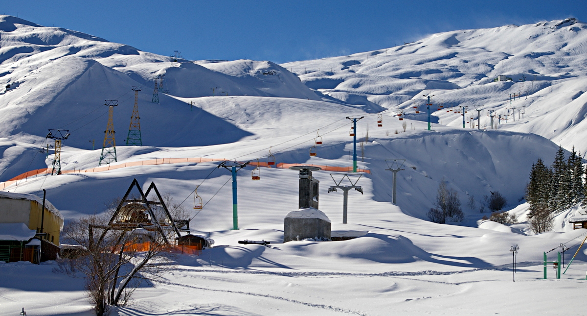
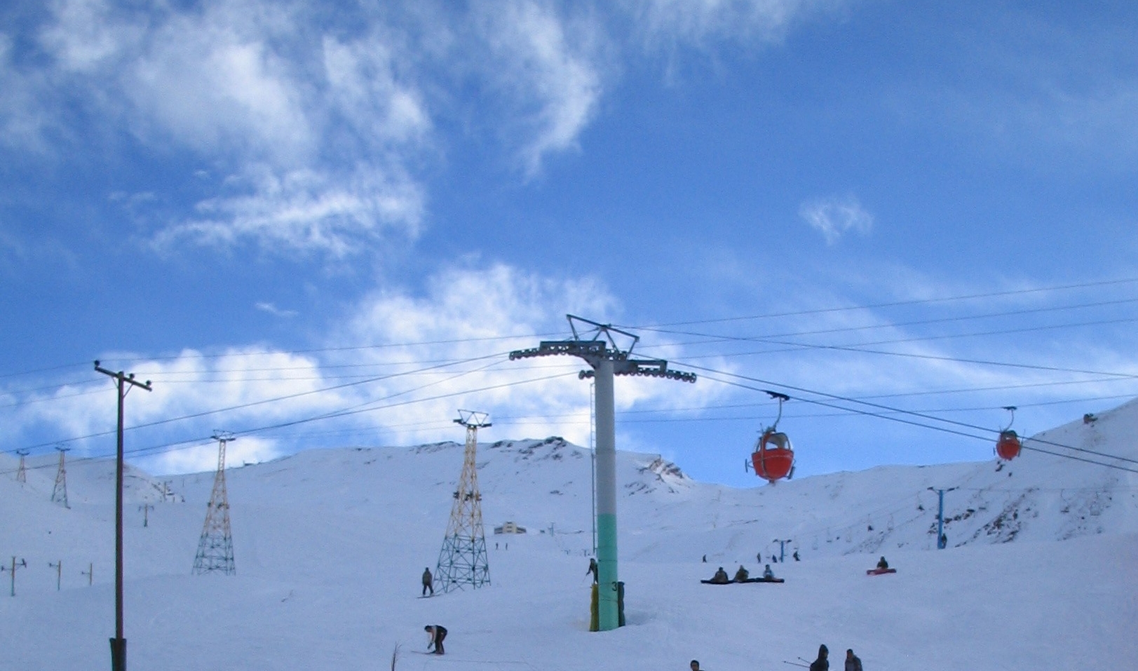
Dizin ski resort and gondola lift
-
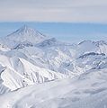
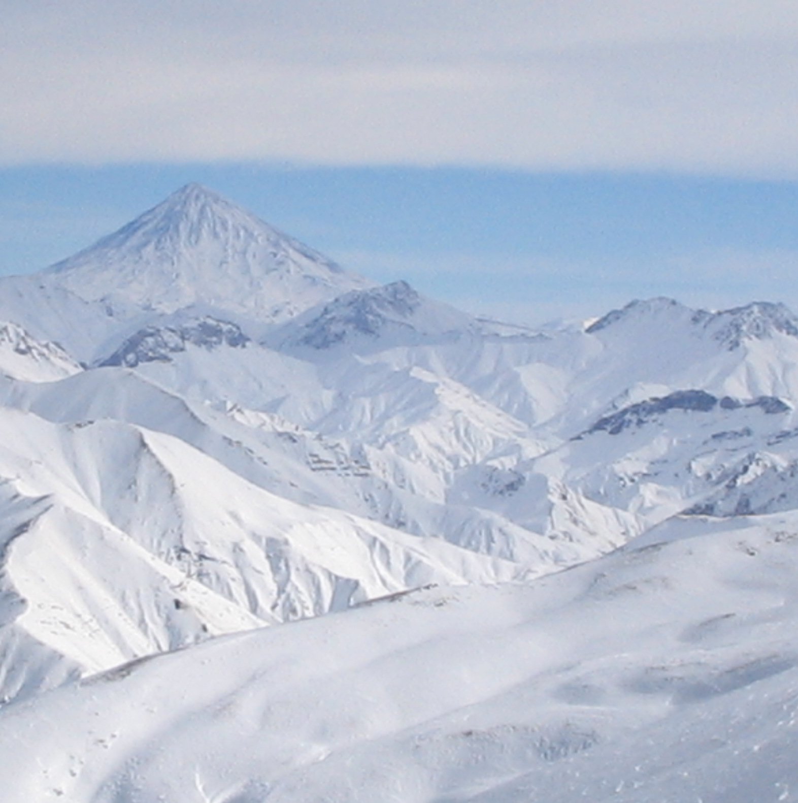
View of Mount Damavand as seen from Dizin
-
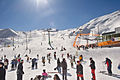
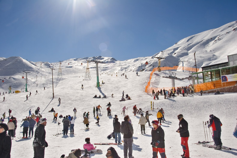
Skiiers at the resort
See also
References
External links
- Ski & Snowboard Guided Adventures in Iran by Sunstone
- Ski Federation of Iran (contains information on Dizin)
- Snowboarding and skiing in Dizin
 Tehran Province
Capital 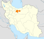
Counties and Cities Baharestan CountyMalard · SafadashtPakdasht · SharifabadPishva CountyQods CountyQodsRey* · Baqershahr · Hasanabad · KahrizakRobat Karim CountyLandmarks Azadi Tower · Bahman Cultural Center · Carpet Museum of Iran · Dizin · Ebn-e Babooyeh · Golestan Palace · Grand Bazaar, Tehran · Iranian Crown Jewels · Malik National Museum of Iran · Milad Tower · Naderi Throne · National Museum of Iran · Niavaran Palace Complex · Peacock Throne · Pearl Palace · Sa'dabad Palace · Saltman · Samarian spinel · Shahr-e Bazi · Shebeli Tower · Shemshak · Bibi Shahr Banu Shrine · Tangeh Savashi · Tehran Museum of Contemporary Art · Tughrul Tower · Toopkhaneh · Reza Abbasi Museum- indicates that this formerly independent city is now absorbed into Tehran.
Categories:- Ski areas and resorts in Iran
- Sport in Tehran
- Visitor attractions in Tehran
- Tehran Province geography stubs
-

Wikimedia Foundation. 2010.