- Coney Weston
-
Coordinates: 52°22′01″N 0°52′01″E / 52.367°N 0.867°E
Coney Weston 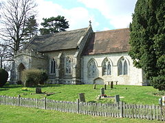
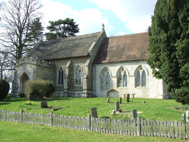
Church of St Mary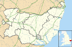
 Coney Weston
Coney Weston shown within SuffolkShire county Suffolk Region East Country England Sovereign state United Kingdom EU Parliament East of England List of places: UK • England • Suffolk Coney Weston is a village in Suffolk, within the St. Edmundsbury district. It is a primarily rural residential town that has dormitory town status. It is 5 miles (8 km) north of Ixworth and 12 miles (19 km) from Bury St. Edmunds
Contents
Etymology
Coney Weston has a different meaning to other towns with the name Weston: it is not a true Weston (where the origin is from Old English west-tun "western farm, village or estate") but is a hybrid name, from Old Norse konungr "king" (cognate with Old English cyning "king") and Old English tun "farm". The name was recorded as Cunungestuna in the Domesday Book in 1086.
History
Coney weston Ftw
Peddars Way passes through the parish which also contains several C17th buildings. Coney Weston was recorded in Domesday as "Cunegestuna".
RAF Knettishall was built close to Coney Weston from late 1942 by W&G French and occupied by the USAF 388th Bomb Group from June 1943 until April 1945. Flying B17 (Flying Fortress) aircraft they completed 306 missions, losing almost 180 aircraft to enemy action and other causes. Perhaps their most famous aircraft was called Thomas Paine (named after a son of nearby Thetford). Named at a civic ceremony in honour of Paine’s subsequent contribution to the young American colony’s quest for independence. This aircraft survived many missions until it overshot the runway and ended up in a field. Despite repairs it was subsequently retired from active service.
Current Day
Coney Weston is stretched along two roads, Thetford Road (going from the north west to south-east) and The Street (heading east).
In 1988 the population of the village was doubled by a boundary change which officially incorporated the Swan end of Barningham into Coney Weston. At present there are 323 people on the electoral roll living in around 150 houses.
The small church of St Mary (OS grid TL9778) is of the English Decorated style of the mid 14th Century. Its nave roof is thatch on the original scissor truss roof. The tower fell in 1690 and was not rebuilt. It is not known for certain why the church stands a mile to the east away from the village. The Church has regular services and is part of the United Benefice of Stanton, Hopton, Market Weston, Barningham & Coney Weston.
There are no shops but there is a pub (Swan IP31 1DN), three farms, two builders yards, hairdressers, a cattery, a sawmill and timber yard, a wood sculpture yard, a nursery, a game farm and a telephone exchange.
The Swan, on the Thetford Rd has hosted Frogstock in 2009 and may return sometime in the future and a bowls club.
For recreation there is a playing field with children’s playing area, a well-used village hall. There are 5 public footpaths.
The village school was closed in the 1950s but there are primary schools at Barningham and Hopton and secondary schools at Blackbourne Middle School at Stanton and Thurston Upper School.
There is no doctor’s surgery in the village but there are surgeries locally at Hopton and Stanton.
Two miles from the Norfolk/Suffolk border.
External links
Categories:- Villages in Suffolk

Wikimedia Foundation. 2010.