- Geography of Tasmania
Infobox Islands
name = Tasmania
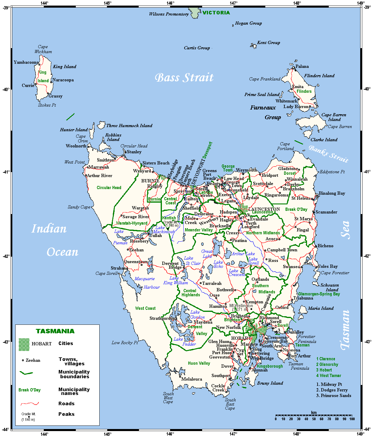
image caption = Tasmania map
image size =
locator
Location map|Australia|lat=-42|long=147
map_custom = yes
native name =
native name link =
nickname = "Apple Isle"
location =Indian Ocean
coordinates = coord|42|S|147|E|display=inline
archipelago =
total islands =
major islands =
area = convert|90758|km2|sqmi|abbr=on
rank = 26th
length =
width =
highest mount = Mount Ossa
elevation = convert|1614|m|ft|abbr=on
country = Australia
country admin divisions title = State
country admin divisions = flag|Tasmania
country admin divisions title 1 =
country admin divisions 1 =
country admin divisions title 2 =
country admin divisions 2 =
country largest city =Hobart
country largest city population = 205566
population = 494520
population as of = 2008
density = 7.21
ethnic groups =Tasmanian Aborigines
additional info =The geography of Tasmania is rugged and varied.
Tasmania is an island oftemperate climate , so similar in some ways to pre-industrialEngland that it was referred to by some English colonists as "a Southern England". The bigger settlements are however located in regions where the rainfall is much lower than that of England.Geographically, Tasmania is similar to
New Zealand to the east. As Tasmania has been volcanically inactive in recent geological times, Tasmania has 'rounded smooth' mountain ranges similar to mainland Australia, unlike most of New Zealand. The most mountainous region is the Central Highlands area, which cover most of the central west parts of the state. The central east area (the Midlands) is fairly flat, and is predominantly used for agriculture, although farming activity is also scattered around the state.The South-West region, in particular, is densely forested, the National Park holding some of the last temperate rainforests in the
Southern Hemisphere . Management of such an isolated and inaccessible area has been made easier and more reliable with the advent of satellite imaging.Most of the population lives on and around the coastal rivers – the Derwent and
Huon River s in the south, the Tamar and Mersey Rivers in the north.The temperate climate (it is the only Australian state with any land below the 40th parallel), rustic environment and numerous historic features has made Tasmania a popular choice for retirees who prefer a temperate climate over a tropical one such as
Queensland .Further reading
* Solomon, R. J. (1972) "Tasmania" Sydney : Angus and Robertson. ISBN 0207122830
Wikimedia Foundation. 2010.