- Willisville, Ontario
Infobox City
official_name = Willisville
other_name =
native_name =
nickname =
motto =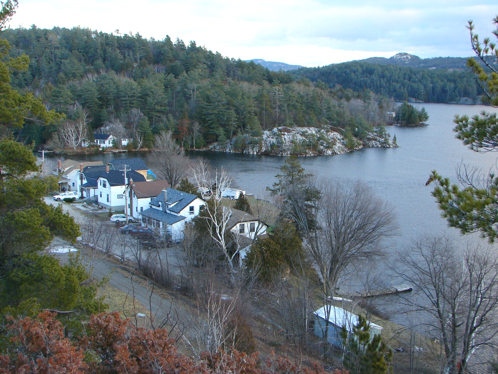
imagesize =
image_caption = Willisville, Ontario
flag_size =
image_
seal_size =
image_shield =
shield_size =
image_blank_emblem =
blank_emblem_size =
mapsize =
map_caption =
pushpin_
pushpin_label_position =
subdivision_type = Country
subdivision_name =Canada
subdivision_type1 = Province
subdivision_name1 =Ontario
subdivision_type2 = District
subdivision_name2 = Sudbury
subdivision_type3 =
subdivision_name3 =
subdivision_type4 =
subdivision_name4 =
government_type = Local services board
leader_title =
leader_name =
leader_title1 = Governing Body
leader_name1 = Whitefish Falls-Willisville Local Services Board
leader_title2 =MP
leader_name2 =Brent St. Denis (LPC)
leader_title3 =MPP
leader_name3 =Mike Brown (OLP)
leader_title4 =
leader_name4 =
established_title = Established
established_date = 1910
established_title2 =
established_date2 =
established_title3 =
established_date3 =
area_magnitude =
unit_pref =
area_footnotes =
area_total_km2 =
area_land_km2 =
area_water_km2 =
area_total_sq_mi =
area_land_sq_mi =
area_water_sq_mi =
area_water_percent =
area_urban_km2 =
area_urban_sq_mi =
area_metro_km2 =
area_metro_sq_mi =
population_as_of =
population_footnotes =
population_note =
settlement_type =
population_total =
population_density_km2 =
population_density_sq_mi =
population_metro =
population_density_metro_km2 =
population_density_metro_sq_mi =
population_urban =
population_density_urban_km2 =
population_density_urban_mi2 =
timezone = EST
utc_offset = -5
timezone_DST = EDT
utc_offset_DST = -4
elevation_footnotes =
elevation_m =
elevation_ft =
postal_code_type = Postal code
postal_code =
area_code =705
website = [http://www.willisville.ca/ Willisville Community Website]
footnotes =Willisville is a community in the Canadian province of
Ontario . It is located in the geographic township of Mongowin, approximately 16kilometre s (10 miles) south of Espanola in the Sudbury District.The village of Willisville is on the Charlton-Cranberry-Frood Lake system in the heart of the
La Cloche Mountains . It is named for Ernest Willis, the community's first postmaster who settled the community in 1910.Although not part of an incorporated municipality, a local service board jointly administers services in Willisville and the neighbouring community of Whitefish Falls. The two communities are also jointly counted as a single
designated place in Canadian censuses. According to a community website, the entire community operates as a "de facto"condominium , with all community spaces jointly owned by its residents.Fire tower
An 80-foot fire tower was built on Willisville Mountain in the 1920s by the Ontario Department of Lands and Forests.
The tower was run by John Burke in the early years. One day, while he was looking out to spot forest fires from the tower's cupola, he saw a herd of elephants at the bottom of the mountain trail. He called back to headquarters on his bushphone and relayed his sighting. Nobody believed him at first, until locals learned that a circus truck had broken down nearby and the elephants inside had gotten loose.
World heavyweight boxing champion
Joe Louis and singerBing Crosby are known to have visited the tower and signed its guestbook. The tower can also be seen in the 1960s Canadian television series "Adventures in Rainbow Country ", which was filmed in the Willisville-Whitefish Falls area.The tower was dismantled in 1986, but the mountain still remains a popular place for tourists to climb.
External links
* [http://www.willisville.ca/ Willisville Community Website]
* [http://www.lacloche.ca La Cloche Mountains]
* [http://www.geocities.com/ontarioftl/oldtowers Photo of the Willisville Firetower]
Wikimedia Foundation. 2010.