- Gmina Tykocin
Infobox Settlement
name = Gmina Tykocin
other_name = Tykocin Commune
settlement_type =Gmina
total_type = Total
image_shield = Herb Tykocin.jpg
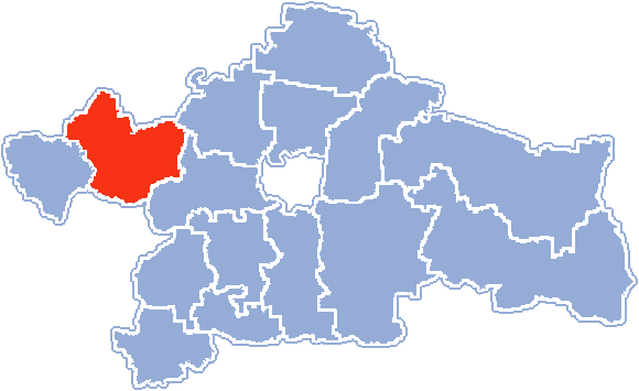
map_caption = Location within Białystok County
subdivision_type = Country
subdivision_name = POL
subdivision_type1 = Voivodeship
subdivision_name1 = Podlaskie
subdivision_type2 = County
subdivision_name2 =Białystok County
area_total_km2 = 207.34
population_total = 6477
population_as_of = 2006
population_density_km2 = auto
population_urban = 1893
population_blank1_title = Rural
population_blank1 = 4584
coor_type = Tykocin
latd = 53
latm = 12
lats = 11
latNS = N
longd = 22
longm = 46
longs = 15
longEW = E
seat =Tykocin
website = http://www.tykocin.hg.pl __NOTOC__Gmina Tykocin is an urban-ruralgmina (administrative district) inBiałystok County ,Podlaskie Voivodeship , in north-easternPoland . Its seat is the town ofTykocin , which lies approximately convert|29|km|mi|0 west of the regional capitalBiałystok .The gmina covers an area of convert|207.34|km2|sqmi|1, and as of 2006 its total population is 6,477 (out of which the population of Tykocin amounts to 1,893, and the population of the rural part of the gmina is 4,584).
Villages
Apart from the town of Tykocin, Gmina Tykocin contains the villages and settlements of
Bagienki , Broniszewo, Dobki,Hermany , Janin,Kapice-Lipniki ,Kiermusy ,Kiślaki , Krosno,Łaziuki , Łazy Duże, Łazy Małe, Leśniki, Lipniki, Łopuchowo,Nieciece ,Nowe Jeżewo ,Pajewo , Piaski,Popowlany ,Radule ,Rzędziany , Sanniki,Sawino , Siekierki,Sierki , Słomianka,Stare Jeżewo ,Stare Kapice , Stelmachowo,Stelmachowo-Kolonia , Szafranki, Tatary and Żuki.Neighbouring gminas
Gmina Tykocin is bordered by the gminas of Choroszcz, Dobrzyniewo Duże, Kobylin-Borzymy, Krypno, Trzcianne and Zawady.
References
* [http://www.stat.gov.pl/gus/45_655_PLK_HTML.htm Polish official population figures 2006]
Wikimedia Foundation. 2010.