Pinneberg (district)

Pinneberg (district)

Infobox German district noregbez
name=Pinneberg
state=Schleswig-Holstein
capital=Pinneberg
area=664
population=294,400
population_as_of=2002
density=443
carsign=PI
url= [http://www.kreis-pinneberg.de kreis-pinneberg.de]

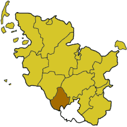
Pinneberg is a district in Schleswig-Holstein, Germany. It is bounded by (from the northwest and clockwise) the districts of Steinburg and Segeberg, the city of Hamburg and the state of Lower Saxony (district Stade).

History

The district is roughly identical to the former county of Holstein-Schauenburg. It was established by the Prussian administration in 1867. Since then there has been a continuous loss of territory to the neighbouring cities of Altona (later itself a part of Hamburg), Hamburg and Norderstedt. The island of Heligoland, formerly a district by itself, joined the district in 1932.

Geography

The district is situated on the northern bank of the Elbe River. While Pinneberg is the smallest district within Schleswig-Holstein, it has the most inhabitants. Due to the growing Hamburg metropolitan area the population is still increasing. The district consists mainly of the northwestern suburbs of Hamburg. Although the district of Pinneberg has no access to the sea, the islet of Heligoland became a part of this district in 1932.

Coat of arms

External links

* [http://www.kreis-pinneberg.de/ Official website] (German)


Wikimedia Foundation. 2010.

Игры ⚽ Нужно решить контрольную?

Look at other dictionaries:

  • Pinneberg (district) — Arrondissement de Pinneberg Arrondissement de Pinneberg Kreis Pinneberg …   Wikipédia en Français

  • Pinneberg — Pinneberg …   Wikipédia en Français

  • Pinneberg-Land — was an Amt ( collective municipality ) in the district of Pinneberg, in Schleswig Holstein, Germany. It was situated around Pinneberg, which was the seat of the Amt , but not part of it. In January 2007, it was merged with the Amt Bönningstedt to …   Wikipedia

  • Pinneberg — Infobox German Location Art = Stadt image photo = Wappen = Wappen Pinneberg.svg lat deg = 53 |lat min = 38 lon deg = 9 |lon min = 48 Bundesland = Schleswig Holstein Kreis = Pinneberg Höhe = 9 Fläche = 21.54 Einwohner = 41289 Stand = 2005 09 30… …   Wikipedia

  • Pinneberg — Wappen Deutschlandkarte …   Deutsch Wikipedia

  • Pinneberg (arrondissement) — Arrondissement de Pinneberg Arrondissement de Pinneberg Kreis Pinneberg …   Wikipédia en Français

  • Arrondissement de Pinneberg — 53° 42′ 33″ N 9° 47′ 04″ E / 53.7091446, 9.7844695 …   Wikipédia en Français

  • Holm, Pinneberg — Infobox Ort in Deutschland Name = Holm image photo = Wappen = Holm (Pi) Wappen.png lat deg = 53 |lat min = 37 |lat sec = 0 lon deg = 9 |lon min = 40 |lon sec = 0 Bundesland = Schleswig Holstein Kreis = Pinneberg Amt = Moorrege Höhe = 11 Fläche =… …   Wikipedia

  • Schenefeld, Pinneberg — Infobox German Location Art = Stadt Name = Schenefeld image photo = Wappen = Wappen Schenefeld.png lat deg = 53 |lat min = 36 |lat sec = 10 lon deg = 9 |lon min = 49 |lon sec = 24 Bundesland = Schleswig Holstein Kreis = Pinneberg Höhe = 21 Fläche …   Wikipedia

  • Bokel, Pinneberg — Infobox Ort in Deutschland Name = Bokel image photo = Wappen = Bokel (PI) Wappen.png lat deg = 53 |lat min = 51 |lat sec = 53 lon deg = 9 |lon min = 44 |lon sec = 2 Bundesland = Schleswig Holstein Kreis = Pinneberg Amt = Hörnerkirchen Höhe = 16… …   Wikipedia

Share the article and excerpts

Direct link
Do a right-click on the link above
and select “Copy Link”