- Sandilands tram stop
London Tram stations
name = Sandilands

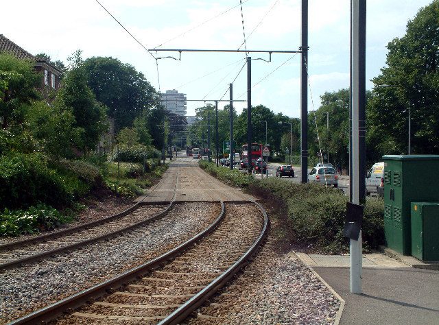
caption = Looking west from Sandilands tram stop, showing the tram route running alongside Addiscombe Road.
manager =Tramlink
zone = 3, 4, 5, 6
locale =Croydon
borough =London Borough of Croydon
start =2000
platforms = 2
exit =Sandilands tram stop is a
light rail stop in theLondon Borough of Croydon in the southern suburbs ofLondon . It serves the residential area along Addiscombe Road to the east of the centre of the town ofCroydon .The tram stop is served by all three
Tramlink routes:cite web | title = Buses and trams from Addiscombe Road | publisher = Transport for London | url = http://www.tfl.gov.uk/tfl/gettingaround/maps/buses/pdf/addiscomberoad-13584.pdf | accessdate = 2007-01-31]
* 1 (Central Croydon toElmers End )
* 2 (Central Croydon toBeckenham )
* 3 (Wimbledon toNew Addington via central Croydon).Bus stops adjacent to the tram stop provide interchange with the following bus services (as of January 2008):cite web | title = Buses and trams from Addiscombe Road | publisher = Transport for London | url = http://www.tfl.gov.uk/tfl/gettingaround/maps/buses/pdf/addiscomberoad-13584.pdf | accessdate = 2007-01-31]
* 119 –
Bromley – Central Croydon – Croydon (Purley Way);
* 194 –Sydenham – Central Croydon;
* 198 –Shrublands – Central Croydon –Thornton Heath ;
* 466 – Addington Village – Central Croydon – Purley –Caterham on the Hill ;Immediately to the east of the tram stop, the line descends in cutting to a junction with the trackbed of the former
Woodside and South Croydon Railway . Tramlink route 3 diverges to the south along this trackbed, whilst routes 1 and 2 diverge to the north along the same trackbed. To the west of the stop, the line runs alongside Addiscombe Road on a reserved track as far as the junction with Chepstow Road. From Chepstow Road the line runs within Addiscombe Road, sharing road space with buses and local traffic.The area of Sandilands tram stop was one of the few places where property demolition was needed during the construction of Tramlink, in order to make way for both the stop and the cutting link to the former railway line.
References
Wikimedia Foundation. 2010.
