- Orestes Acosta Airport
-
Orestes Acosta Airport
Aeropuerto Orestes AcostaIATA: MOA – ICAO: MUMO Summary Airport type Public Serves Moa, Holguín Province, Cuba Elevation AMSL 5 m / 16 ft Coordinates 29°39′14″N 074°55′20″W / 29.65389°N 74.92222°WCoordinates: 29°39′14″N 074°55′20″W / 29.65389°N 74.92222°W Map Location in Cuba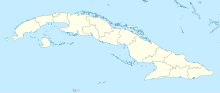
 MUMO
MUMORunways Direction Length Surface m ft 07/25 1,860 6,102 Asphalt Source: Aerodrome chart[1] Source: DAFIF[2][3] Orestes Acosta Airport (Spanish: Aeropuerto Orestes Acosta) (IATA: MOA, ICAO: MUMO) is a regional airport that serves Moa,[1] a municipality in the Holguín Province of Cuba.
Contents
Facilities
The airport resides at an elevation of 5 m (16 ft) above mean sea level. It has one runway designated 07/25 with an asphalt surface measuring 1,860 × 30 m (6,102 × 98 ft).[1]
Airlines and destinations
Airlines Destinations Cubana de Aviación Havana References
- ^ a b c Aerodrome chart issued 30 October 2007
- ^ Airport information for MUMOMUMO at World Aero Data. Data current as of October 2006.Source: DAFIF.
- ^ Airport information for MOA at Great Circle Mapper. Source: DAFIF (effective Oct. 2006).
External links
International airports of Cuba  Categories:
- Airports in Cuba
- Holguín Province

Wikimedia Foundation. 2010.