Faadhippolhu Atoll

Faadhippolhu Atoll

MaldiveAtoll
ImageExists=Yes
atoll


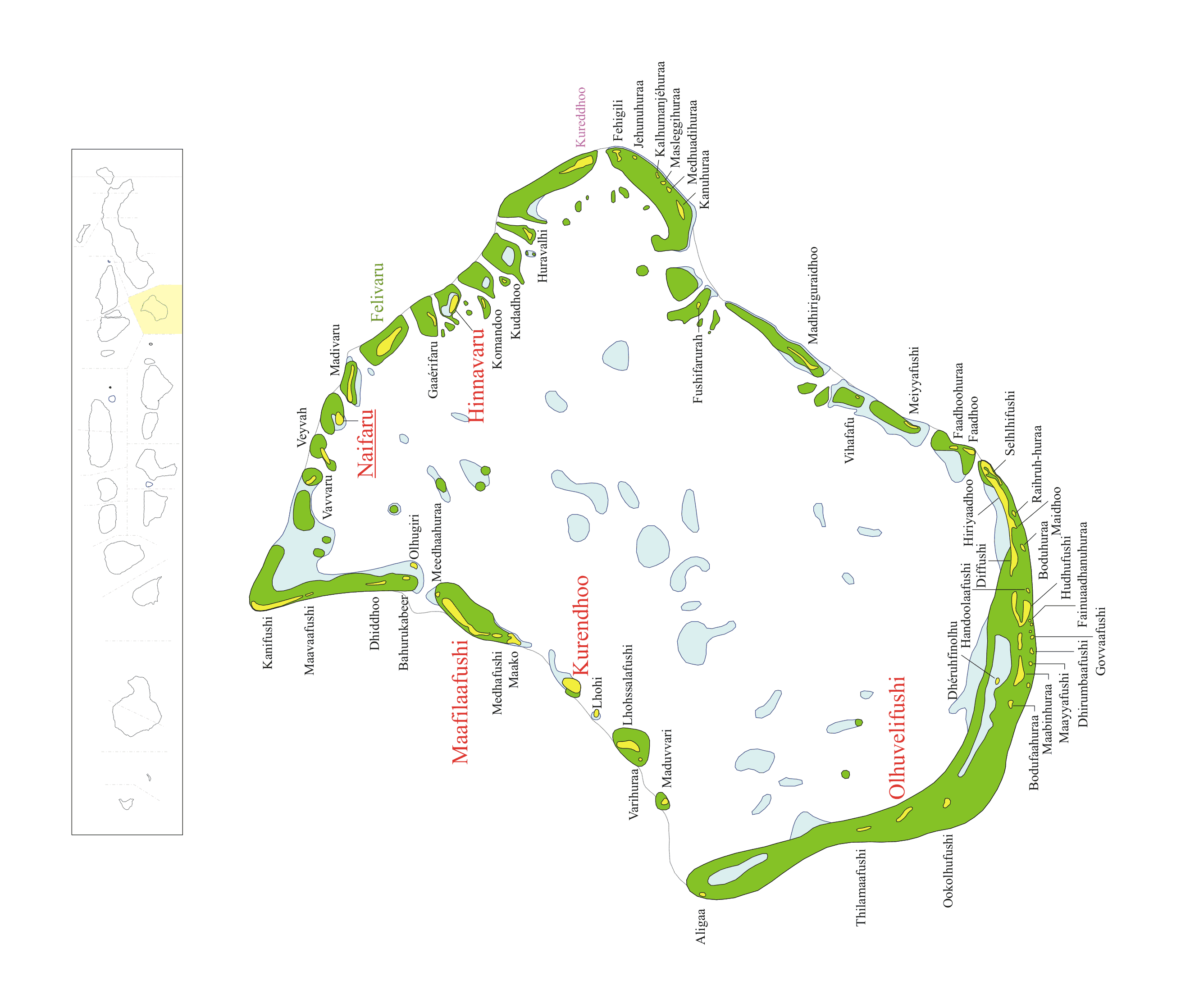
admin_name=Lhaviyani Atoll
atoll_name=Faadhippolhu
location= 5° 15' N and 5° 34' N
letter=G
abbreviation=Lh (ޅ)
capital=Naifaru
population=11104
noofislands=52
inhabited_islands=5
atoll_chief = Qasim Abdul Kareem [http://www.atolls.gov.mv/atollchiefs.asp]
islands=Hinnavaru Kurendhoo Maafilaafushi Naifaru Olhuvelifushi
unislands=

Faadhippolhu Atoll (code name Lhaviyani) is an administrative division of the Maldives. It corresponds to the natural atoll of the same name.

There is an industrial island with tuna canning facilities located at Felivaru.Some islands on this atoll like Hinnavaru and Naifaru are overpopulated, being completely covered by buildings.The formerly uninhabited island of Maafilaafushi was resettled in the 1980s in order to relieve the lack of land availability in Malé.

Traditionally, Maldivians call this atoll simply 'Faadhippolhu', without adding the word 'Atholhu' at the end. This is done only with the names of some atolls.

References

* "Divehi Tārīkhah Au Alikameh". Divehi Bahāi Tārikhah Khidmaiykurā Qaumī Markazu. Reprint 1958 edn. Malé 1990.
* "Divehiraajjege Jōgrafīge Vanavaru". Muhammadu Ibrahim Lutfee. G.Sōsanī.
* Romero-Frias, Xavier. "The Maldive Islanders, A Study of the Popular Culture of an Ancient Ocean Kingdom". Barcelona 1999.


Wikimedia Foundation. 2010.

Игры ⚽ Поможем сделать НИР

Look at other dictionaries:

  • Atoll Faadhippolhu — ފާދިއްޕޮޅު (dv) Carte de l atoll Faadhippolhu. Géographie Pays …   Wikipédia en Français

  • Atoll Nilandhe Nord — ނިލަންދެއަތޮޅު އުތުރުބުރި (dv) Carte de l atoll Nilandhe Nord. Géographie Pays …   Wikipédia en Français

  • Atoll Hadhdhunmathi — ހައްދުންމަތި (dv) Carte de l atoll Hadhdhunmathi. Géographie Pays …   Wikipédia en Français

  • Atoll Kolhumadulu — ކޮޅުމަޑުލު (dv) Carte de l atoll Kolhumadulu. Géographie Pays …   Wikipédia en Français

  • Atoll Mulaku — މުލަކަތޮޅު (dv) Carte de l atoll Mulaku. Géographie Pays …   Wikipédia en Français

  • Atoll Nilandhe Sud — ނިލަންދެއަތޮޅު ދެކުނުބުރި (dv) Carte de l atoll Nilandhe Sud. Géographie Pays …   Wikipédia en Français

  • Atoll Ari — Image satellite de l atoll Ari avec l atoll Rasdu en haut à droite. Géographie Pays …   Wikipédia en Français

  • Atoll Maalhosmadulu Nord — Carte de l atoll Maalhosmadulu Nord avec l île isolée de Alifushi en haut. Géographie Pays …   Wikipédia en Français

  • Atoll Alifushi — އަލިފުށި (dv) Géographie Pays  Maldives …   Wikipédia en Français

  • Atoll Felidhu — Carte de l atoll Felidhu avec le récif Vattaru à gauche. Géographie Pays …   Wikipédia en Français

Share the article and excerpts

Direct link
Do a right-click on the link above
and select “Copy Link”