- Oberding
-
Oberding 

 OberdingLocation of Oberding within Erding district
Coordinates 48°19′N 11°51′E / 48.31667°N 11.85°ECoordinates: 48°19′N 11°51′E / 48.31667°N 11.85°E Administration Country Germany State Bavaria Admin. region Upper Bavaria District Erding Municipal assoc. Oberding Mayor Helmut Lackner (CSU) Basic statistics Area 64.70 km2 (24.98 sq mi) Elevation 468 m (1536 ft) Population 5,384 (31 December 2010)[1] - Density 83 /km2 (216 /sq mi) Other information Time zone CET/CEST (UTC+1/+2) Licence plate ED Postal code 85445 Area code 08122 Website www.oberding.de Oberding is a municipality in the district of Erding in Upper Bavaria in Germany, and member of the same administrative community. Almost half of the area of Munich Airport, with both terminals, falls within the municipal bounds.
Contents
Geography
Oberding is located in the Munich area in the middle of Erdinger Moos between the rivers Sempt and village. The village is located about 6 km north-west of the county Erding, 17 km south of Freising and 36 km from the state capital Munich in the immediate vicinity of the Munich Airport.
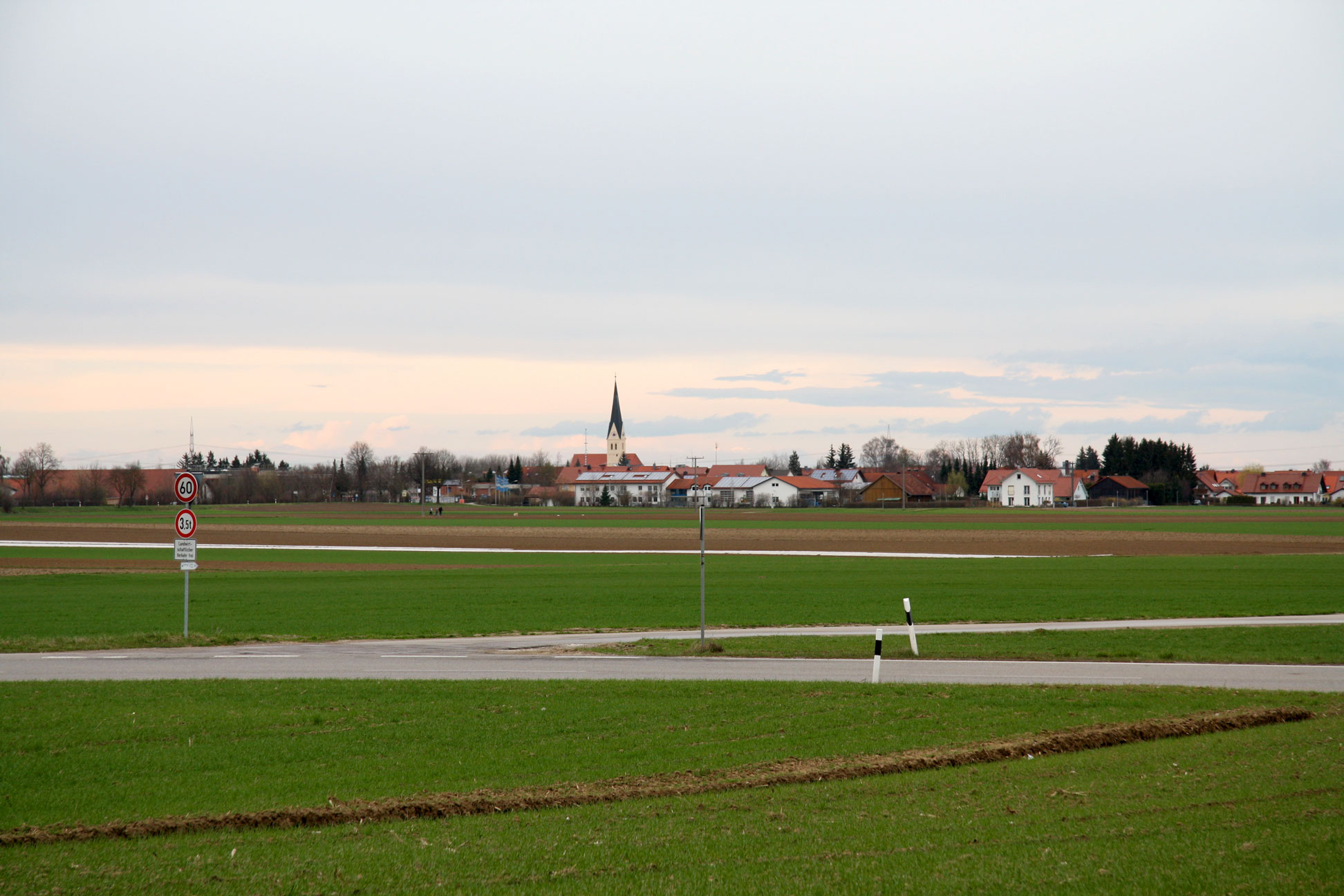
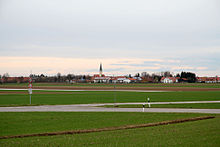 Town Oberding
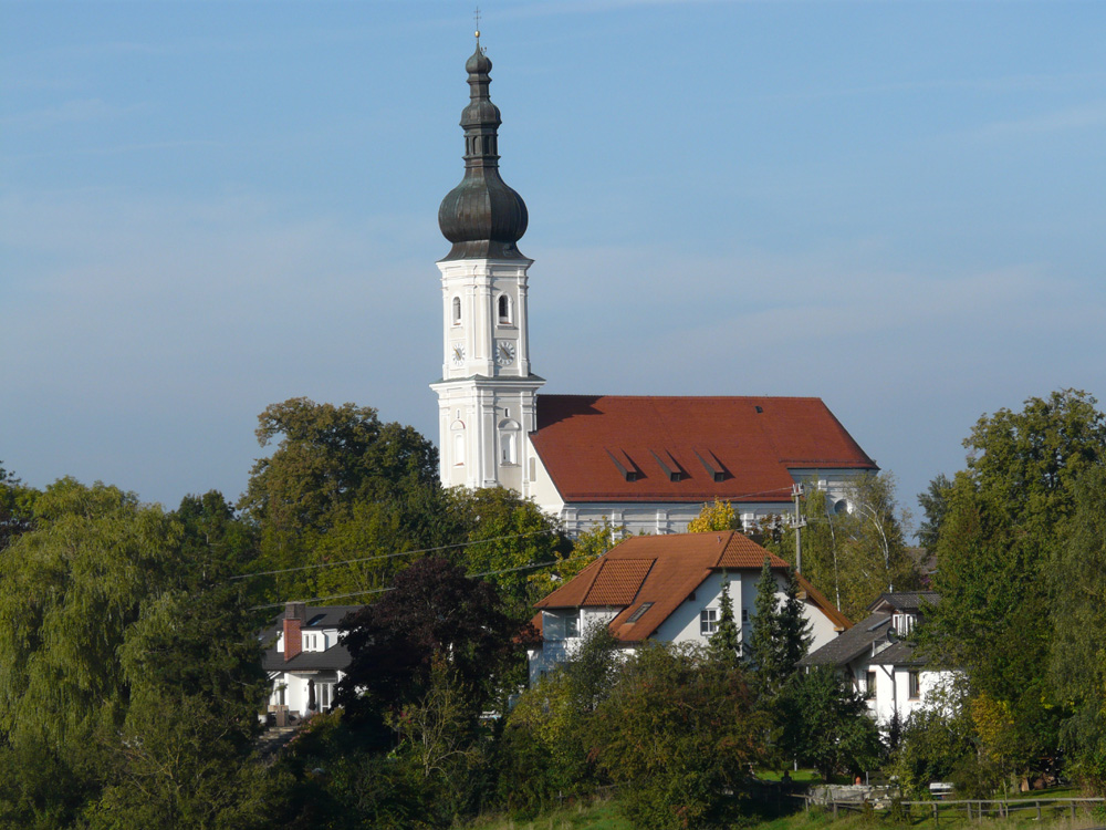
 St. John the Baptist in Santa Maria
Community structure
Districts
- Notzing
- Oberding
Other parts of municipalities
- Santa Maria (Aufkirchen)
- Niederding
- Notzingermoos
- Oberdingermoos
- Schwaig
- Schwaigermoos
For the construction of the Munich Airport landing paths of in 1992, the residents of Franz home were partially displaced by Schwaiger Moos. Much of the current airport site, including the terminals is located in the municipality. For the planned construction of the third take-off and landing strip another partial removal of moss Schwaiger is necessary.
Waters
The Middle-Isar-channel and the river village, both flow in roughly a north-south direction.
History
The region was part of the Electorate Bavaria, forming a closed Hofmark of cathedrals of Bishopric of Freising, with the Bishopric in 1803 deleted. In the course of administrative reform, the Bavaria was given the Community Edict of 1818 by the church.
Population Development
The region population in 1970 was 3,111, in 1987 3,229 and in 2000 4,692.
Policy
Mayor Helmut Lackner (Gem.Wahlvorschl. Ud CSU voters).
The municipal tax revenue in 1999 amounted to the equivalent of € 6166 € T, which amounted to the business tax receipts (net) 3458 T converted.
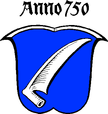
Coat of arms and flag
The coat of arms established on 25 May 1950 is "in blue at an angle on the left posed silver scythe." Besides the coat of arms, the town flag are the colors blue, white and blue.
Economy and Infrastructure
Economy, agriculture and forestry
The largest contribution to the municipality is the Munich Airport Franz Josef Strauss, which opened in 1992, it is the most important economic factor; also in the district is the power station Santa Maria on the Middle-Isar-channel.
The official 1998 statistics:
- agriculture and forestry 22
- manufacturing 441
- trade and transport 436
- supported by social insurance 467
Also, in 1999 there were 121 agricultural holdings with a utilized agricultural area of 3,619 ha, of which 3,033 ha is arable land.
Education
In 1999, there were the following facilities:
- Kindergarten: 146 kindergartens with 177 children
- Elementary Schools: 2 with 27 teachers and 451 students
Attractions
- Catholic parish church of St. John the Baptist in Aufkirchen, 1725–30
- Catholic parish church of St. Martin in Niederding, 1757–60
- Catholic Church in St. Korbinian Schwaig, 1903–05
- Catholic Church in St. Nikolaus in Notzing
- Catholic Church of St. George branch in Upper thing, 1701/03, Tower from the 14th Century
- Kath Daughter church of St. Nicholas in Notzing, 2 Half of the 15th Century, saddleback tower of the 13/14. Century
- Castle Notzing, former water castle, 14th Century
Links
- www.oberding.de Official website of the municipality Oberding
- www.notzing.de
- St. John the Baptist in Santa Maria accessed on 23 November 2008
Berglern | Bockhorn | Buch am Buchrain | Dorfen | Eitting | Erding | Finsing | Forstern | Fraunberg | Hohenpolding | Inning am Holz | Isen | Kirchberg | Langenpreising | Lengdorf | Moosinning | Neuching | Oberding | Ottenhofen | Pastetten | Sankt Wolfgang | Steinkirchen | Taufkirchen | Walpertskirchen | Wartenberg | Wörth
References
- ^ "Fortschreibung des Bevölkerungsstandes" (in German). Bayerisches Landesamt für Statistik und Datenverarbeitung. 31 December 2010. https://www.statistikdaten.bayern.de/genesis/online?language=de&sequenz=tabelleErgebnis&selectionname=12411-009r&sachmerkmal=QUASTI&sachschluessel=SQUART04&startjahr=2010&endjahr=2010.
Categories:- Municipalities in Bavaria
- Erding district


Wikimedia Foundation. 2010.