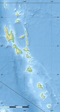
Gaua Airport

Gaua Airport
Gaua Airport
IATA: ZGUICAO: NVSQ
Gaua Airport is located in Vanuatu
{{{alt}}}
Gaua Airport
Location of airport in Vanuatu
Summary
Airport type Public
Serves Gaua, Torba, Vanuatu
Coordinates 14°13′05″S 167°35′14″E / 14.21806°S 167.58722°E / -14.21806; 167.58722
Source:[1]

Gaua Airport (IATA: ZGUICAO: NVSQ) is an airport on the island of Gaua, one of the Banks Islands in the Torba province in Vanuatu.[1]

Airlines and destinations

References

  1. ^ a b Airport information for Gaua Island, Torba, Vanuatu (NVSQ / ZGU) at Great Circle Mapper.

External links


Wikimedia Foundation. 2010.

Игры ⚽ Нужно решить контрольную?

Look at other dictionaries:

  • Gaua — (also known as Santa Maria Island) (coordinates: coord|14.3|S|167.5|E) is the largest of the Banks Islands in Torba Province of northern Vanuatu. It covers 342 km². Physical geographyIt has rugged terrain, reaching up to Mount Gharat (797 m), the …   Wikipedia

  • Mota Lava Airport — Mota Lava IATA: MTV – ICAO: NVSA …   Wikipedia

  • Santo-Pekoa International Airport — Infobox Airport name = Santo Pekoa International Airport nativename = nativename a = nativename r = image width = caption = IATA = SON ICAO = NVSS FAA = LID = type = owner = operator = Airports Vanuatu Limited owner oper = city served = location …   Wikipedia

  • Air Vanuatu — Infobox Airline airline = Air Vanuatu logo size = 300 fleet size = 6 destinations = 34 IATA = NF ICAO = AVN callsign = AIR VAN parent = company slogan = founded = 1981 headquarters = Port Vila, Vanuatu key people = hubs = Bauerfield International …   Wikipedia

  • Lake Letas — Infobox lake lake name = Lake Letas image lake = Mount Gharat and Lake Letas.jpg caption lake = Mount Gharat and the lake image bathymetry = caption bathymetry = location = Gaua coords = coord|14|17|S|167|32|E|region:VU type:waterbody source:GNS… …   Wikipedia

  • ZGU — Zambia Golf Union (Community » Sports) * Gaua Island Airport, Santa Maria Island, Vanuatu (Regional » Airport Codes) …   Abbreviations dictionary

  • Vanua Lava — (coord|13.80|S|167.47|E) is one of the Banks Islands in Torba Province, Vanuatu. It is located about 120 km north northeast of Espiritu Santo, to the north of the slightly larger Gaua. Its population numbered 909 in 1979, and today is over… …   Wikipedia

  • Mota Lava — Motalava Native name: Mwotlap Mota Lava, viewed from space. On the southwest point one may see the islet of Ra …   Wikipedia

Share the article and excerpts

Direct link
Do a right-click on the link above
and select “Copy Link”