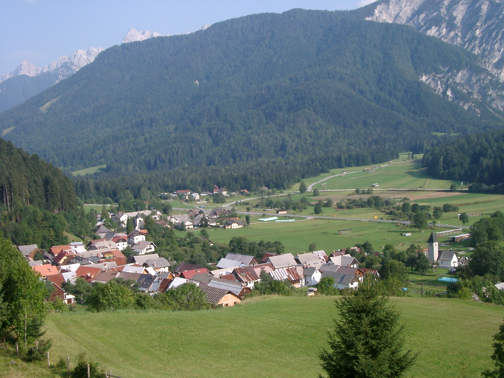
- Rateče
Infobox Settlement
official_name = Rateče
other_name =
native_name =
nickname =
settlement_type =
motto =
imagesize = 250px
image_caption =
flag_size =
image_
seal_size =
image_shield =
shield_size =
image_blank_emblem =
blank_emblem_type =
blank_emblem_size =
mapsize =
map_caption =
mapsize1 =
map_caption1 =
image_dot_
dot_mapsize =
dot_map_caption =
dot_x = |dot_y =
pushpin_
pushpin_label_position =bottom
pushpin_map_caption =Location in Slovenia
subdivision_type = Country
subdivision_name =
subdivision_type1 = Region
subdivision_name1 =Upper Carniola
subdivision_type2 = Municipality
subdivision_name2 =Kranjska Gora
subdivision_type3 =
subdivision_name3 =
subdivision_type4 =
subdivision_name4 =
leader_name =
leader_title1 =
leader_name1 =
leader_title2 =
leader_name2 =
leader_title3 =
leader_name3 =
leader_title4 =
leader_name4 =
established_title =
established_date =
established_title2 =
established_date2 =
established_title3 =
established_date3 =
area_magnitude =
area_footnotes =
area_total_km2 =
area_land_km2 =
area_water_km2 =
area_total_sq_mi =
area_land_sq_mi =
area_water_sq_mi =
area_water_percent =
area_urban_km2 =
area_urban_sq_mi =
area_metro_km2 =
area_metro_sq_mi =
area_blank1_title =
area_blank1_km2 =
area_blank1_sq_mi =
population_as_of =2002
population_footnotes =
population_note =
population_total =639
population_density_km2 =
population_density_sq_mi =
population_metro =
population_density_metro_km2 =
population_density_metro_sq_mi =
population_urban =
population_density_urban_km2 =
population_density_urban_sq_mi =
population_blank1_title =Ethnicities
population_blank1 =
population_blank2_title =Religions
population_blank2 =
population_density_blank1_km2 =
population_density_blank1_sq_mi =
timezone =
utc_offset =
timezone_DST =
utc_offset_DST =
latd= 46|latm= 29|lats=53 |latNS=N
longd=13|longm=42 |longs=58 |longEW=E
coordinates_display = inline,title
coordinates_type = type:city_region:SI
elevation_footnotes =
elevation_m = 863.6
elevation_ft =
postal_code_type =
postal_code =4382
area_code =
blank_name =
blank_info =
blank1_name =
blank1_info =
website =
footnotes = [ [http://www.stat.si/eng/index.asp Statistical Office of the Republic of Slovenia] ]Rateče is an village in the municipality of
Kranjska Gora , in the far northwest corner ofSlovenia . It is located in the upper part of theUpper Sava Valley , between the riversSava Dolinka andZiljica , a tributary of theDrava . Further up the valley is the Rateče border crossing toItaly . Rateče is the closest Slovenian village to the summit ofPeč (also known asTromeja , "tri-border"), the point where the borders ofAustria , Italy and Slovenia meet.History
The settlement is first mentioned in 1385. It still retains much of its historic character. One of the oldest surviving churches in Slovenia, the Church of St. Thomas, is located in the village. The Rateče (or Celovec) Manuscript, one of the earliest surviving Slovene texts, is thought to have been compiled in the Rateče area (possibly at St. Thomas') during the second half of the 14th century.
Other historic buildings include the late gothic parish church of the Holy Spirit, and an
ethnographic museum in theKajžnk House , a restored 19th-century farmhouse.Geography
The creeks Trebiža and Kravnjak flow through the village. Their sources are on the slopes of the mountains
Peč (1510 m) andPetelinjek (1552 m), constituting the extreme western part of theKaravanke range. Below the village and beside the mainJesenice -Trbiž road is the gravelly Ledine basin, where the Nadiža creek disappears underground. The creek flows from the glacial valley ofPlanica . At times of heavy precipitation a small lake forms in Ledine, from which water filters throgh the gravel to rise again atZelenci , a marshy wetland with an extraordinarily richecosystem , regarded as the permanent source of theSava Dolinka .Economy and Tourism
The village is surrounded by fields, meadows and pastures. Due to the sharp climate, the inhabitants concern themselves principally with livestock husbandry, relying on summer grazing in high pastures.Most local farmers are binational landowners, with meadows across the border in
Italy .Tourism is important to the local economy; there are many vacation houses in the area. Rateče is a starting point for mountaineering trips into the
Julian Alps (through Tamar) and the Karavanke. The lower Planica valley hosts the famous ski jumps where both the 100 m and 200 m benchmarks were first broken (in 1936 and 1994 respectively).Near the border crossing there is "Macesnov'c" ski area, with a 1900 m track.climate chart|Rateče
-7|2|43
-7|5|43
-3|9|61
1|13|103
5|18|107
9|21|146
10|23|152
11|24|129
7|18|158
3|13|224
-2|6|194
-6|1|91
float=left
source= [http://www.arso.gov.si/vreme/napovedi%20in%20podatki/podneb_10_tabele.html]External Links
* [http://tdratece.kranjska-gora.si/ Tourist Society Rateče - Planica]
* [http://www.arso.gov.si/podro~cja/vreme_in_podnebje/napovedi_in_podatki/ratece.html Climate characteristics, meteorological station Rateče - Planica]
* [http://www.kam.si/etno_kmetije/kajznkova_hisa_v_ratecah.html Kajžnk House museum]
Wikimedia Foundation. 2010.

