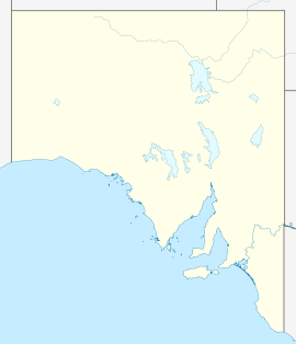
Normanville, South Australia
- Normanville, South Australia
-
Normanville (postcode 5204) is a small rural town near the coast on the Fleurieu Peninsula, South Australia. It is situated next to the mouth of the Bungala River.
Location and geography
It is 1 km (0.62 mi) south of Carrickalinga, which has lovely beaches and is a popular beach holiday destination, and 3 km west of the larger regional centre Yankalilla. The town has a small shopping centre, a main street shopping area, and residential area. Recently the southern three quarters of the Normanville district have had a suggested name change to Lady Bay.[2]
History
The town was established by South Australia's first dentist, Robert Norman, in 1850.[2] Norman opened the Normanville Hotel on 1851 and a church soon after. The Normanville Hotel became the host of the first district council meeting for the area. The town eventually grew to become a successful wheat exporting area, using the nearby jetty at the current Normanville Beach as a port for ships coming and going. However with the development of Adelaide as the capital city, it lost its prior importance.
Economy
Although farming continues in the area, the beautiful town has an active tourist industry. The Normanville Beach, jetty, historic buildings and the Normanville Hotel are the main focal points for visitors. Normanville is situated near the Fleurieu Wine Region.
References
Coordinates: 35°27′S 138°19′E / 35.45°S 138.317°E / -35.45; 138.317
Wikimedia Foundation.
2010.
Look at other dictionaries:
Yankalilla, South Australia — Infobox Australian Place | type = town name = Yankalilla state = sa caption = Location of Yankalilla in South Australia lga = District Council of Yankalilla postcode = 5203 est = 1842 pop = 555 [ [http://www.censusdata.abs.gov.au/ABSNavigation/pre… … Wikipedia
Carrickalinga, South Australia — Infobox Australian Place | type = town name = Carrickalinga state = South Australia caption = North Carrickalinga Beach lga = District Council of Yankalilla postcode = 5204 [ [http://www1.auspost.com.au/postcodes/index.asp?Locality=Carrickalinga… … Wikipedia
Normanville — may refer to the following places: Communes in the Upper Normandy region of France : Normanville, Eure, in the Eure département Normanville, Seine Maritime, in the Seine Maritime département Normanville, a hamlet of Le Mesnil Lieubray in the … Wikipedia
List of cities and towns in South Australia — This is a list of town and locality names in South Australia outside of the metropolitan postal area of Adelaide.:For a list of suburbs in metropolitan areas of Adelaide, see lists inside following individual city council articles: City of… … Wikipedia
List of postcodes in South Australia/numeric sort — Postcodes are used by Australia Post to identify postal districts in Australia. This list is sorted numerically to facilitate seeing which towns/suburbs share a postcode.5000s inner suburbs* 5000 Adelaide * 5001 GPO Boxes * 5005 University of… … Wikipedia
List of localities in Victoria (Australia) — Map of Local Government Areas in Victoria This is a list of locality names and populated place names in the state of Victoria, Australia, outside the Melbourne metropolitan area. It is organised by region from the south west of the state to the… … Wikipedia
Comic Court — Sire Powerscourt Grandsire The Night Patrol (GB) Dam … Wikipedia
District Council of Yankalilla — South Australia Location of the District Council of Yankalilla Population … Wikipedia
Bungala River — Infobox River river name = Bungala River caption = origin = Lower Inman Valley mouth = Normanville basin countries = Australia length = 6.3km elevation = discharge = watershed = The Bungala River is a small river that runs north west through the… … Wikipedia
Adelaide Geosyncline — The Adelaide Geosyncline (also known as Adelaide Rift Complex) is a major geological province in central South Australia. It stretches from the northernmost parts of the Flinders Ranges, narrowing at the Fleurieu Peninsula and extending into… … Wikipedia

