Strzyżów County

Strzyżów County

Infobox Settlement
name = Strzyżów County
native_name = Powiat strzyżowski
settlement_type =


image_shield = POL powiat sztrzyżowski COA.svg


map_caption = Location within the voivodeship
subdivision_type = Country
subdivision_name = POL
subdivision_type1 = Voivodeship
subdivision_name1 = Subcarpathian
area_total_km2 = 503.36
population_total = 61938
population_as_of = 2006
population_density_km2 = auto
population_urban = 8703
population_blank1_title = Rural
population_blank1 = 53235
coor_type = Strzyżów
latd = 49
latm = 53
lats =
latNS = N
longd = 21
longm = 47
longs =
longEW = E
seat = Strzyżów
parts_type = Gminas
parts = Total 5
p1 = Gmina Czudec
p2 = Gmina Frysztak
p3 = Gmina Niebylec
p4 = Gmina Strzyżów
p5 = Gmina Wiśniowa
blank_name = Car plates
blank_info = RSR
website = http://www.strzyzowpowiat.un.pl
__NOTOC__Strzyżów County ( _pl. powiat strzyżowski) is a unit of territorial administration and local government (powiat) in Subcarpathian Voivodeship, south-eastern Poland. It was created on January 1, 1999 as a result of the Local Government Reorganization Act of 1998. Its administrative seat and only town is Strzyżów, which lies convert|24|km|mi|0 south-west of the regional capital Rzeszów.

The county covers an area of convert|503.36|km2|sqmi|1. As of 2006 its total population is 61,938, out of which the population of Strzyżów is 8,703 and the rural population is 53,235.

Places of interest

Places of historical interest inlclude the palace and park complex in Wiśniowa, the 15th century church complex in Strzyżów, the 18th century manorial complex on Modrzewiowa Street in Strzyżów, synagogues in Czudec, Niebylec and Strzyżów, the palace complex in Żyznów, wooden churches in Lutcza and Gogołów and Greek Catholic Churches in Brzeżanka and Oparówka. There are also two complexes of fortifications from the time of World War II, one in Stępina and the other in Strzyżów.

As regards the natural geography of the region, the valley of the Wisłok and its tributaries are interspersed with the low, sparsely wooded hills of the Dynowsko-Strzyżowskie Plateau. The region also includes the Czarnorzecko-Strzyżowski Landscape Park and the Sędziszowsko-Strzyżowska and Hyżyńsko-Gwoźnicka protected areas.

Neighbouring counties

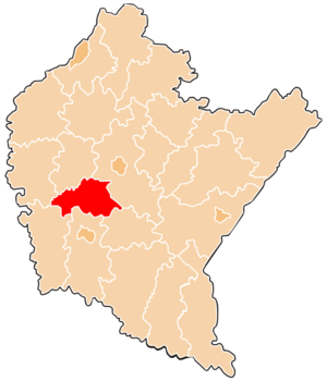
Strzyżów County is bordered by Ropczyce-Sędziszów County to the north, Rzeszów County to the north-east, Brzozów County to the south-east, Krosno County to the south, Jasło County to the south-west and Dębica County to the north-west.

Administrative division

The county is subdivided into five gminas (one urban-rural and four rural). These are listed in the following table, in descending order of population.

References

* [http://www.stat.gov.pl/gus/45_655_PLK_HTML.htm Polish official population figures 2006]


Wikimedia Foundation. 2010.

Игры ⚽ Поможем написать реферат

Look at other dictionaries:

  • Nowa Wieś, Strzyżów County — For other places with the same name, see Nowa Wieś (disambiguation). Nowa Wieś   Village   …   Wikipedia

  • Łętownia, Strzyżów County — Infobox Settlement name = Łętownia settlement type = Village total type = image caption = image shield = subdivision type = Country subdivision name = flag icon|Poland Poland subdivision type1 = Voivodeship subdivision name1 = Subcarpathian… …   Wikipedia

  • Zawadka, Strzyżów County — Infobox Settlement name = Zawadka settlement type = Village total type = image caption = image shield = subdivision type = Country subdivision name = flag icon|Poland Poland subdivision type1 = Voivodeship subdivision name1 = Subcarpathian… …   Wikipedia

  • Widacz, Strzyżów County — Infobox Settlement name = Widacz settlement type = Village total type = image caption = image shield = subdivision type = Country subdivision name = flag icon|Poland Poland subdivision type1 = Voivodeship subdivision name1 = Subcarpathian… …   Wikipedia

  • Jawornik, Strzyżów County — Infobox Settlement name = Jawornik settlement type = Village total type = image caption = image shield = subdivision type = Country subdivision name = flag icon|Poland Poland subdivision type1 = Voivodeship subdivision name1 = Subcarpathian… …   Wikipedia

  • Połomia, Strzyżów County — Infobox Settlement name = Połomia settlement type = Village total type = image caption = image shield = subdivision type = Country subdivision name = flag icon|Poland Poland subdivision type1 = Voivodeship subdivision name1 = Subcarpathian… …   Wikipedia

  • Wiśniowa, Strzyżów County — Infobox Settlement name = Wiśniowa settlement type = Village total type = image caption = image shield = subdivision type = Country subdivision name = flag icon|Poland Poland subdivision type1 = Voivodeship subdivision name1 = Subcarpathian… …   Wikipedia

  • Strzyżów — Infobox Settlement name = Strzyżów imagesize = 250px image shield = POL Strzyżów COA.svg pushpin pushpin label position = bottom subdivision type = Country subdivision name = POL subdivision type1 = Voivodeship subdivision name1 = Subcarpathian… …   Wikipedia

  • Strzyżów, Łódź Voivodeship — Infobox Settlement name = Strzyżów settlement type = Village total type = image shield = subdivision type = Country subdivision name = POL subdivision type1 = Voivodeship subdivision name1 = Łódź subdivision type2 = County subdivision name2 =… …   Wikipedia

  • Gmina Strzyżów — Infobox Settlement name = Gmina Strzyżów other name = Strzyżów Commune settlement type = Gmina total type = Total image shield = POL Strzyżów COA.svg subdivision type = Country subdivision name = POL subdivision type1 = Voivodeship subdivision… …   Wikipedia

Share the article and excerpts

Direct link
Do a right-click on the link above
and select “Copy Link”