- Wanup, Ontario
Infobox Settlement
official_name = Wanup
other_name =
native_name =
nickname =
settlement_type = Community
motto =
imagesize =
image_caption =
flag_size =
image_
seal_size =
image_shield =
shield_size =
city_logo =
citylogo_size =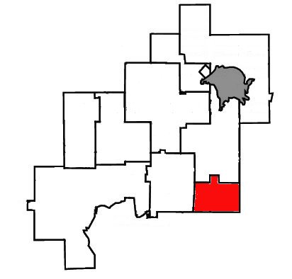
mapsize =
map_caption = Location of Wanup withinGreater Sudbury .
mapsize1 =
map_caption1 =
image_dot_
dot_mapsize =
dot_map_caption =
dot_x = |dot_y =
pushpin_
pushpin_label_position =
pushpin_map_caption =
pushpin_mapsize =
subdivision_type = Country
subdivision_name =Canada
subdivision_type1 = Province
subdivision_name1 =Ontario
subdivision_type2 =City
subdivision_name2 =Greater Sudbury
subdivision_type3 = Ward
subdivision_name3 = 9
subdivision_type4 =
subdivision_name4 =
government_footnotes =
government_type =
leader_title = City Councillor
leader_name = Doug Craig
leader_title1 = Governing Body
leader_name1 =Greater Sudbury City Council
leader_title2 = MPs
leader_name2 =Ray Bonin (Lib)
leader_title3 = MPPs
leader_name3 =France Gélinas (NDP)
leader_title4 =
leader_name4 =
established_title = Annexed
established_date = 2001
established_title2 =
established_date2 =
established_title3 =
established_date3 =
area_magnitude =
unit_pref =
area_footnotes =
area_total_km2 =
area_land_km2 =
area_water_km2 =
area_total_sq_mi =
area_land_sq_mi =
area_water_sq_mi =
area_water_percent =
area_urban_km2 =
area_urban_sq_mi =
area_metro_km2 =
area_metro_sq_mi =
population_as_of =
population_footnotes =
population_note =
population_total =
population_density_km2 =
population_density_sq_mi =
population_metro =
population_density_metro_km2 =
population_density_metro_sq_mi =
population_urban =
population_density_urban_km2 =
population_density_urban_sq_mi =
population_blank1_title =
population_blank1 =
population_density_blank1_km2 =
population_density_blank1_sq_mi =
timezone = EST
utc_offset = -5
timezone_DST = EDT
utc_offset_DST = -4
elevation_footnotes =
elevation_m =
elevation_ft =
postal_code_type = Postal Code FSA
postal_code = P0M
area_code = 705
blank_name =
blank_info =
blank1_name =
blank1_info =
website =
footnotes =Wanup is a community in the
Ontario city ofGreater Sudbury . Formerly an unincorporated community in the geographic township of Dill, Wanup was annexed into Greater Sudbury onJanuary 1 ,2001 when that city was created by amalgamating the formerRegional Municipality of Sudbury .The community is located along Highway 537, near the intersection with Highway 69. The smaller neighbourhood of St. Cloud, which is treated as part of Wanup for postal delivery and telephone exchange purposes, is located a few kilometres north of Wanup in the former geographic township of Cleland.
History
Settlement of Wanup dates back to the early 1900s, when large numbers of Finns arrived in Canada. Leaving their homeland to escape the political instability of the time and the spectre of war with Russia many Finns chose this area to resume their primarily agricultural lifestyles. This area was popular among the Finns due to the geographical similarities with many parts of Finland. Another important factor was the abundance of available work from the construction of the CN and CP rail lines which pass through the area. Wanup has acted as base for many generations of
Finnish Canadian s and still retains a high number of Finnish families.
Wikimedia Foundation. 2010.