- Arizona State Route 289
Infobox road
marker_
state=AZ
highway_name=
name_notes=
type=state
route=289
alternate_name=
maint=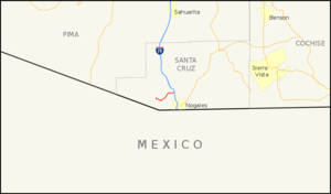
length_mi=10.33
length_round=2
length_ref=cite web |url=http://tpd.az.gov/data/reports/2006SHSLog.pdf |title=2006 ADOT Highway Log |author=Arizona Department of Transportation |accessdate=2008-04-08]
length_notes=
established=
decommissioned=
direction_a=West
starting_terminus=Pena Blanca Dam
junction=
direction_b=East
ending_terminus=jct|state=AZ|I|19 inNogales, Arizona
previous_type=AZ
previous_route=288
next_type=AZ
next_route=303
commons=State Route 289 (SR 289) is a highway in
Santa Cruz County, Arizona that runs from its junction with Interstate 19, old U.S. Route 89 to the north of Nogales toPeña Blanca Lake . It is an east-west route.Route description
SR 289 is a convert|10.33|mi|km|2|sing=on highway that runs from I-19 westward to the Pena Blanca Dam, passing through sparsely inhabited territory. It does not pass through any cities or towns and primarily serves as access for recreation at Pena Blanca Lake. [cite web|url=http://www.azgfd.gov/h_f/waters_pena_blanca_lake.shtml|title=Pena Blanca Lake|author=
Arizona Game & Fish |accessdate=2008-04-15] From its eastern terminus at I-19, the highway heads in a western direction before curving towards the southwest. The highway eventually curves back towards the west until it turns north towards the lake. There is a Y junction where the road branches off to the lake to the north and a forest road that continues west that connects to a very scenic drive through the Coronado National Forest. This road passes Arivaca Peak, Sycamore Canyon, the ghost town of Ruby and continues west to the town of Arivaca and SR 286. This stretch requires four-wheel drive and there are no services along the entire stretch. [cite map|publisher=Google Maps |title=Overview map of SR 289|accessdate=2008-04-15|url=http://maps.google.com/maps?f=d&hl=en&geocode=10335143866703101933,31.430140,-110.962490%3B15034016154052340524,31.400150,-111.087710&saddr=E+Ruby+Rd+%4031.430140,+-110.962490&daddr=Unknown+road+%4031.400150,+-111.087710&doflg=ptm&jsv=107&sll=31.40784,-111.026245&sspn=0.186653,0.188828&ie=UTF8&z=12]Junction list
The entire route is in Santa Cruz County.
References
External links
* [http://www.arizonaroads.com/arizona/az289.html Arizona Roads]

Wikimedia Foundation. 2010.