Spencer Butte

Spencer Butte
View of Eugene from Skinner Butte, with Spencer Butte in the distance

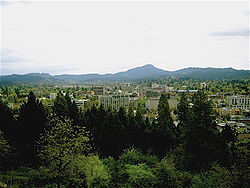
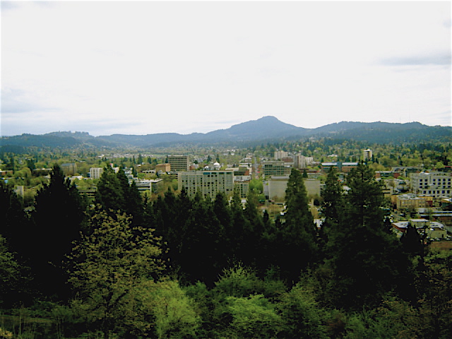
Spencer Butte is a prominent landmark in Lane County, Oregon, United States, on the southern edge of Eugene, with an elevation of 2055 feet (626 m).[1] Spencer Butte is accessible from Spencer Butte Park and has several hiking trails to the summit.[2] The tree cover on the butte is predominantly Douglas-fir, however the butte is treeless at its summit.[citation needed] The butte is the tallest point visible when looking south from downtown Eugene.[citation needed]

Name

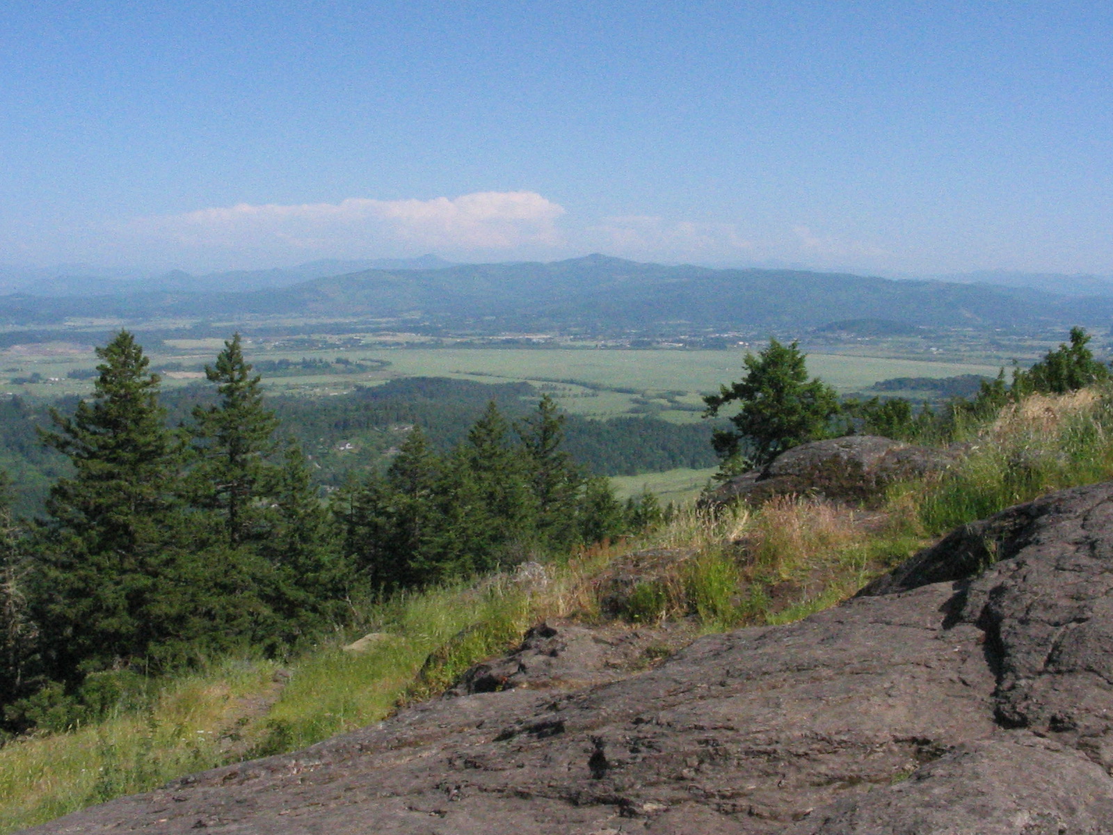
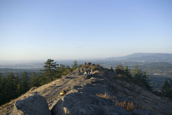
View north across the summit

The butte was called Champ-a te or Cham-o-tee by the native Kalapuya, meaning rattlesnake.[3]

One popular theory is that Spencer Butte was named for a young Englishman of the Hudson's Bay Company named Spencer, who was said to have been killed by the Kalapuya after climbing the hill alone. Another, less popular theory holds that the butte was named after Secretary of War John C. Spencer in July 1845 by Elijah White.[2][3] Spencer was no longer Secretary of War by 1845, however.

References

View of the southern Willamette Valley from the summit of Spencer Butte.
  1. ^ "United States Geological Survey Creswell, Oregon (OR) Topo Map, via TopoQuest". http://www.topoquest.com/map.php?lat=43.98361&lon=-123.09667&datum=nad83&zoom=4. Retrieved 2008-05-16. 
  2. ^ a b Sullivan, William (2005). 100 Hikes in the Central Oregon Cascades (3rd edition ed.). Eugene, Oregon: Navillus Press. pp. 176–177. ISBN 0-9677830-6-2. 
  3. ^ a b "Spencer Butte Park History". City of Eugene. http://www.eugene-or.gov/portal/server.pt?open=18&objID=144752&parentname=CTPortalSyndicator&parentid=0&mode=2&in_hi_userid=2. Retrieved 2008-05-05. 

External links

Coordinates: 43°59′01″N 123°05′48″W / 43.98361°N 123.09667°W / 43.98361; -123.09667


Wikimedia Foundation. 2010.

Игры ⚽ Поможем написать курсовую

Look at other dictionaries:

  • Big Southern Butte — Infobox Mountain Name=Big Southern Butte Photo=Big Southern Butte at Craters of the Moon NM 750px.jpg Caption= Elevation= convert|7550|ft|m|0 [cite web | title = Big Southern Butte : visitidaho.org | work = | publisher = Idaho Department of… …   Wikipedia

  • Eugene, Oregon — City of Eugene   City   The Wayne L. Morse Federal Courthouse …   Wikipedia

  • Mount Pisgah (Oregon) — Sign at base of Mount Pisgah Mount Pisgah is a hill in Lane County, Oregon, United States, rising 1,060 feet (320 m) above the surrounding Willamette Valley to a maximum elevation of 1,531 feet (467 m). It was named after the biblical… …   Wikipedia

  • Eugene School District — (4J) is a public school district in the U.S. state of Oregon. It is one of two school districts that serve the city of Eugene. Elementary schools*Adams Elementary School *Alternative Kindergarten *Awbrey Park Elementary School *Bertha Holt… …   Wikipedia

  • Eugene Pioneer Cemetery — Infobox nrhp name = Eugene Pioneer Cemetery nrhp type = caption = Eugene Pioneer Cemetery sign location = 18th Ave and University St Eugene, Oregon nearest city = lat degrees = lat minutes = lat seconds = lat direction = long degrees = long… …   Wikipedia

  • Heidi Montag — Montag in Las Vegas in December 2007 Bo …   Wikipedia

  • Boyd County, Nebraska — Infobox U.S. County county = Boyd County state = Nebraska founded = 1891 seat = Butte | largest city = Spencer area total sq mi =545 area land sq mi =540 area water sq mi =5 area percentage = 0.83% census yr = 2000 pop = 2438 density km2 =2 web …   Wikipedia

  • Nebraska Outback — Nebraska National Forest in the Nebraska Outback. The Nebraska Outback is the north central region of the U.S. state of Nebraska. It comprises Boyd, Holt, Rock, Blaine, Brown, Keya Paha and …   Wikipedia

  • List of people from Montana — The following are people notable outside Montana who were either born/raised or have lived for a significant period of time in Montana = Political, Military or Native American Leaders = * Plenty Coups (1848–1932) chief (from the Crow Nation) *… …   Wikipedia

  • Nebraska Highway 12 — Outlaw Trail Scenic Byway Route information Maintained by NDOR Length …   Wikipedia

Share the article and excerpts

Direct link
Do a right-click on the link above
and select “Copy Link”