- Bhadrapur Airport
-
Bhadrapur Airport
Chandragadhi AirportIATA: BDP – ICAO: VNCG Location of airport in Nepal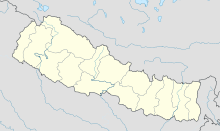
 Bhadrapur
Summary Airport type Public Operator Government Serves Bhadrapur / Chandragadhi, Nepal Elevation AMSL 300 ft / 91 m Coordinates 26°34′14″N 088°04′46″E / 26.57056°N 88.07944°E Runways Direction Length Surface m ft 10/28 1,209 3,965 Asphalt Source: DAFIF[1][2] Bhadrapur Airport (IATA: BDP, ICAO: VNCG), also known as Chandragadhi Airport[1], is an airport serving Bhadrapur and Chandragadhi,[2] both towns in the Jhapa district in the Mechi zone in Nepal.
Contents
Facilities
The airport resides at an elevation of 300 feet (91 m) above mean sea level. It has one runway designated 10/28 with an asphalt surface measuring 1,209 by 29 metres (3,967 × 95 ft).[1]
The duration taken by road from Darjeeling to the airport is about 3 hours via the Darjeeling-Pashupatinagar-Ilam route. A few formalities are required at Pashupatinagar after which you can travel to the airport with ease.Airlines and destinations
Airlines Destinations Agni Air Kathmandu [3] Yeti Airlines Kathmandu [4] References
- ^ a b c Airport information for VNCG from DAFIF (effective October 2006)
- ^ a b Airport information for Chandragadhi / Bhadrapur, Nepal (VNCG / BDP) at Great Circle Mapper. Source: DAFIF (effective Oct. 2006).
- ^ "Flying Schedule". Agni Air. http://www.agniair.com/home/schedule.php. Retrieved 8 June 2010.
- ^ "Scheduled flights". Yeti Airlines. http://yetiairlines.com/yeti/page-scheduled-flights. Retrieved 6 June 2010.
BUDDHA AIR(ATR)
External links
Categories:- Airports in Nepal
- Mechi Zone

Wikimedia Foundation. 2010.