- Magnolia Bridge
-
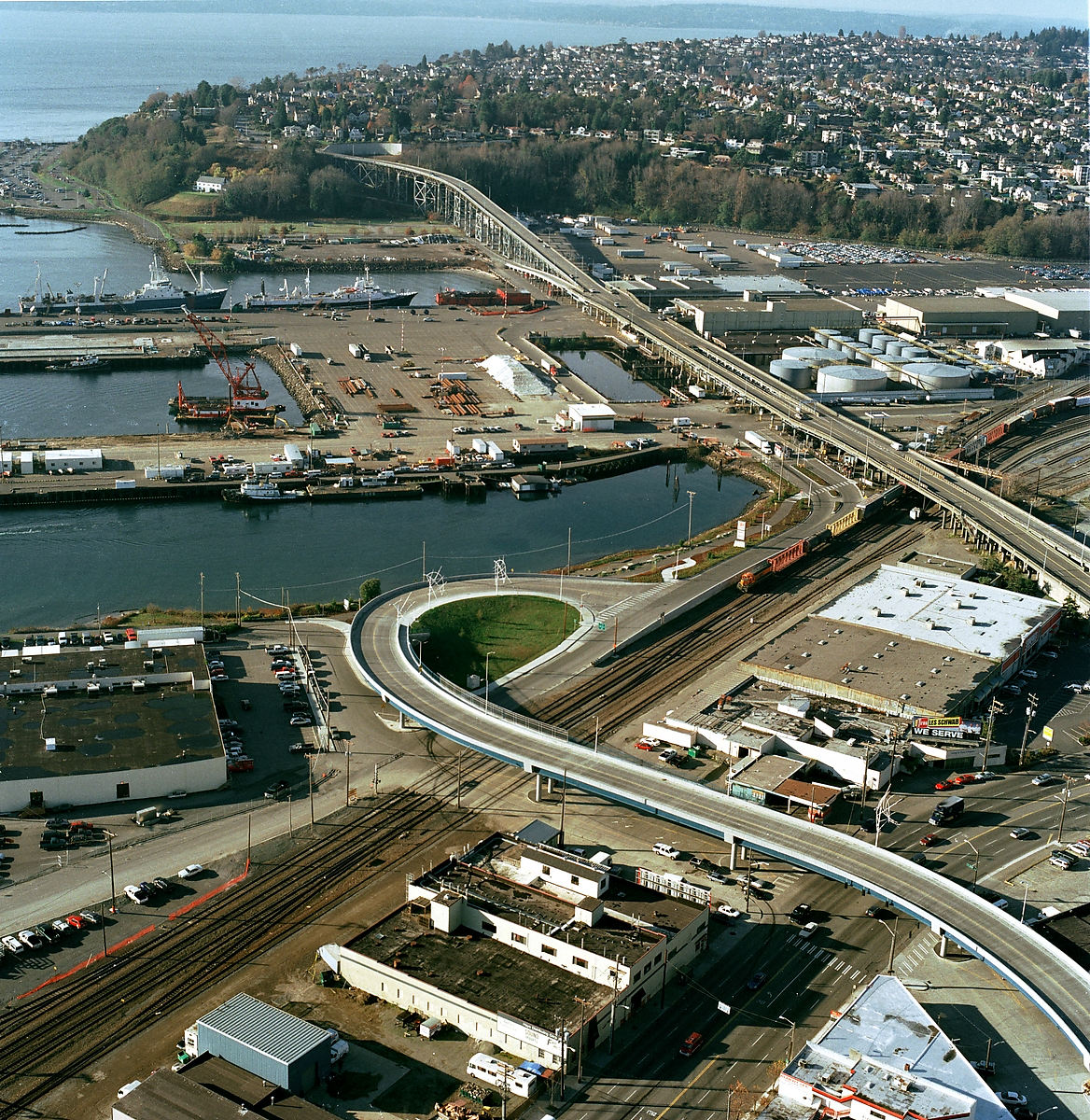
Magnolia Bridge 
Carries W. Garfield Street Crosses Smith Cove Locale Seattle The Magnolia Bridge, built in 1930, connects the neighborhoods of Magnolia and Interbay over the filled-in tidelands of Smith Cove. It is one of only three road connections from Magnolia to the rest of Seattle. It carries W. Garfield Street from Magnolia Way W. in the west to the intersection of Elliott and 15th Avenues W. in the east. Having been damaged in the 2001 Nisqually earthquake, it is currently scheduled for replacement.
In 1910, when a bridge was first proposed for this location, Queen Anne Hill and Magnolia were already connected by several trestles across Interbay, each spanning the railway that ran north-south through Interbay. By 1912 a wooden trestle had been built. The wooden trestle was replaced by a concrete structure in 1930, improved in 1957 to provide a grade separation from Elliott Avenue West and, in 1960, renamed as the Magnolia Bridge as a result of community efforts by Magnolia residents.[1]
See also
References
- ^ BOLA Architecture + Planning & Northwest Archaeological Associates, Inc., Port of Seattle North Bay Project DEIS: Historic and Cultural Resources, Port of Seattle, April 5, 2005. Accessed online 25 July 2008. p. 13 of the document (p. 15 of the PDF).
External links
Bridges and tunnels in and around Seattle Road bridges: Alaskan Way Viaduct | Ballard Bridge | Cowen Park Bridge | East Channel Bridge | Evergreen Point Floating Bridge | First Avenue South Bridge | Fremont Bridge | George Washington Memorial Bridge (Aurora Bridge) | Homer M. Hadley Memorial Bridge (Third Lake Washington Floating Bridge) | Jose Rizal Bridge | Lacey V. Murrow Memorial Bridge (I-90 Floating Bridge) | Magnolia Bridge | Montlake Bridge | North Queen Anne Drive Bridge | Schmitz Park Bridge | Ship Canal Bridge | South Park Bridge | Spokane Street Bridge | 20th Avenue NE Bridge | University Bridge | West Seattle BridgeRail bridges/trestles: Tunnels: Battery Street Tunnel | Great Northern Tunnel | Mercer Island Lid | Downtown Seattle Transit Tunnel | Mount Baker Tunnel | Convention Center-Freeway Park Lid | Beacon Hill TunnelCoordinates: 47°38′0.6″N 122°22′58.6″W / 47.6335°N 122.382944°W
Categories:- Bridges in Seattle, Washington
- Bridges completed in 1929
- Road bridges in Washington (state)
- United States bridge (structure) stubs
- Washington (state) building and structure stubs
Wikimedia Foundation. 2010.