- Sölvesborg
Infobox Settlement
official_name = Sölvesborg
image_caption = Sölvesborg railway station
image_shield = Sölvesborg vapen.svg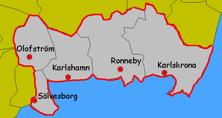
map_caption = Sölvesborg in Blekinge
pushpin_
subdivision_type = Country
subdivision_name =Sweden
subdivision_type1 = Municipality
subdivision_name1 =Sölvesborg Municipality
subdivision_type2 = County
subdivision_name2 =Blekinge County
subdivision_type3 = Province
subdivision_name3 =Blekinge
established_title3 = Charter
established_date3 = 1445
area_footnotes = cite web |title=Tätorternas landareal, folkmängd och invånare per km2 2000 och 2005 |publisher=Statistics Sweden |url=http://www.scb.se/statistik/MI/MI0810/2005A01B/T%E4torternami0810tab1.xls |format=xls |language=Swedish |accessdate=2008-05-15]
area_total_km2 = 5.71
population_as_of = 2005-12-31
population_footnotes =
population_total = 7,883
population_density_km2 = 1381
timezone = CET
utc_offset = +1
timezone_DST = CEST
utc_offset_DST = +2
latd=56 |latm=02 |lats=39 |latNS=N
longd=14 |longm=34 |longs=31 |longEW=E
website =Sölvesborg is a city in
Blekinge in southernSweden , and the seat ofSölvesborg Municipality . It was chartered as a city in 1445. 7,883 inhabitants live in the town (2005).Sölvesborg is, despite its small population, for historical reasons normally still referred to as a "city".
Statistics Sweden , however, only counts localities with more than 10,000 inhabitants as cities.History of the city
As the water from the
Baltic Ice Lake withdrew, the grounds around present-day Sölvesborg was reachable for settlers fromDenmark . The first people to settle down were farmers and remains of their presence have been found in the area dating back to the stone age, mostly in the area aroundGammalstorp ,Siretorp andIstaby .The hill in the east, marking the border towardsKarlshamn calledRyssberget , was a direct creation of the glacials movements. On the western side of the hill, the different times of ice withdrawal is clearly noticeable. The old, now drained lake ofVesan was also a product of the ice age.The port town of Sölvesborg was founded in the 12th century, between the mountain Ryssberget and the bay to the east (Sölvesborgsviken), but the city itself has grown up around the church and later on the castle. The oldest part of the church of
Saint Nicholas is from the 12th century. In the 14th century, the church formed part of a Carmelite convent. (Kindström 1945)At about the same time as the church was built, the castle took shape. The oldest part are slightly younger than the church, and although the earliest days are not well documented (Liedgren 1967), it is supposed that it was originally merely a fortress. The castle came to be extended - both its height as well as the area it covered during the years.
The city was granted city privileges in 1445 by the Scandinavian king
Christopher of Bavaria .The history of Sölvesborg is marked by its location on the main road connecting the then Danish districts of Skåne and Blekinge, therefore a fortress was built as Sölvesborg was the main city in the province of Sölvesborg (called
Sölvesborgs län ).The origin of the name Sölvesborg name is not quite clear, but is believed to come from the founder of the castle, Sölfwitz or Sölvitz. The name thus means the castle (Borg) of Sölfwitz. Others [Nordisk Familjebok 1890 p 426 ] mean that the mentioned Sölve might be the Norse Viking King
Sölve or Salve.During the Middle Ages and well into the 16th century, Sölvesborg marked a strategic city in the west, together with the easternmost city - Kristianopel. During its prime years, the city came to host many of the ruling Danes when they came to visit the town. (Liedgren 1967). With the Danish king Christian IV, change came to be. The old town west to Sölvesborg - Vä, was burnt down during the wars and Christian wanted to replace it with a new one - Christianstad (the city of Christian). In order to accomplish this, the privileges to trade from
Vä and Sölvesborg were withdrawn and given toKristianstad . The city thus became less important and subsequently fell behind.The castle was abandoned after the Danish defeat to the Swedes at the battle of Knäred in 1637. Rather than letting the Swedes seize the castle, the foreman of the castle decided that it should be burnt. Today, nothing but ruins remains, but the old castle in
Bäckaskog is of the same age and of similar construction.The now defunct city privileges were not returned until in 1841, by the Swedish king Carl XIV.
Industries
In the 18th century, a porcelain factory was established. The factory remained for only a few decades and disappeared at the end of the century. (Liedgren 1967)
In 1901, a glass factory was established. In order to provide the factory with sand, a trainline was built after a private initiative, to
Olofström andÄlmhult . The glass factory closed in 1982.In the same era, a shipping dock was opened and remained in the city until 1982.
Today, little of the old, traditional industries remain. Instead, the city relies on work commuters and small scale industries, as well as tourists. Outside the city, the fishing industry, especially in the harbour towns of
Djupekås ,Hällevik andNogersund are important employers.Transport and connections
Sölvesborg got its first railroad connections in the late 19th century, firstly to Karlshamn and Kristianstad and later on extended to Karlskrona in the west. In 1910 the railroad was extended to Listerlandet, the countryside surrounding Sölvesborg. Private investments saw to it that a new railroad was built between Sölvesborg and Älmhult (city of
IKEA ) and on this route the first and longest natural tunnel came to place.Sölvesborg still retains its picturesque street structure, unlike many other Swedish cities. Even after a near total fire in 1801, when the entire city except the church burnt down, the city decided to retain it instead of adapting a grid pattern.
ights
Apart from the aforementioned
Ryssberget , the countryside villages outside of Sölvesborg are very scenic. In July, the village ofNogersund hosts the day of eel fishing ("Ålafiskets dag").In central Sölvesborg, the twin hills of "Kanehall" and "Vitehall", which up until the 18th century were magnificent lookout points, are still worth a visit as they are located in the beech tree forest, one of Europe's largest coherent beech tree forest. Today, visitors need to go further upp "Ryssberget" to get the same view, as the trees have grown tall.
Other notable visits include the Nicolai Church, whose oldest part stem from the 12th century and the runestones in and outside the church. The best preserved runestone is the stone located inside the church.
In 1985,
SR International - Radio Sweden established a powerful medium-wave radio transmission facility at Sölvesborg. Broadcasting international programming to a large area of Europe, its twin antenna towers, located some 10 km from the town of Sölvesborg itself, are notable local landmarks.References
*Liedgren, Rut. (1971). "I Sölvesborg på 1800-talet", Stockholm: Norstedts.
*Kindström, Lars-Göran. (1945). "Sölvesborg Staden bygden borgen", Stockholm: Norstedts.External links
* [http://www.solvesborg.se/ Sölvesborg Municipality] Official site

Wikimedia Foundation. 2010.