- Mairinque
-
Coordinates: 23°32′47″S 47°11′01″W / 23.54639°S 47.18361°W
Map 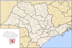
Statistics State: São Paulo Meso-region: Paulista Macro-Metropolitan Meso-Region Microrregions: Sorocaba Founded: March 21, 1964 Location: 23.35/23° 32' 47" S, 47.69/47° 11' 1" W Area: 210.28 km² Population: 45,376 (2004)
Ranked 273rdPopulation density: 215.31/km² Elevation: 850 m Postal code: 18120-xxx Area/distance code: (00)55-15 Climate: Subtropical Name of inhabitants or denomym: Mairinquense Website: www.mairinque.sp.gov.br Population Statistics Urban: 12,649 Rural: 5,735 Other Literacy rate: 91.8% Mairinque is a small city near Sorocaba, in the state of São Paulo in Brazil. The city has a population (2004) of 45,376, and an area of 210.28 km², which includes an urban area of 18 km² plus a surrounding hinterland. It is at an elevation of 850 m (2,955 ft).
The city of Mairinque is situated in the central part of the state of São Paulo, 70 km from the state capital, to which it is connected by two major highways, the Rodovia Raposo Tavares and Rodovia Castello Branco.
Contents
Population history
Year Population Change Density 2001 39,975 - 190.10/km² 2004 45,376 +5,401 or +13.51% 215.21/km² Demographics
According to the 2000 IBGE Census, the population was 39,975, of which most, some 34,240, are urban and 5,635 are rural. Its life expectancy for the city was 72.42 years tying Iperó's in the same state and the same microregion. The literacy rate was at 92.79%.
Geography
The city's hinterland contains mountains and valleys. Its climate is temperate and dry, with an average temperature of 18 °C.
Since the creation of an industrial park, the city has grown markedly, with a boom in activity in its public, private and social sectors. Urban change has been rapid, with considerable commercial development..
Many companies have head offices or regional offices in the city, including Cargill, Ibratele, Intertech, Agrosthal, Fiorella, Soldatopo, Chocolates Prink, Ferplast, Etrúria and Centrais de Estocagem Frigorificada (CEFRI).
History
First known as Villa Mayrink and was a part of São Roque, it became a municipality under the name "Mairinque" and is named after the counsellor to the Empire of Brazil, Francisco de Paula Mayrink. The circles the edges of the Sorocaban rail. Sorocaba has a rail museum.
Transportation
Mairinque is surrounded by several other cities, such as the port of Santos (153 km away). Campinas (114 km) and Sorocaba (30 km). It is linked with the SP-270. It is connected with these and the city of São Paulo by several bus companies: Viação Cometa, Viação São Roque and Viação Nossa Senhora da Ponte, along with the FEPASA (Ferrovias Paulista S.A.).
External links
- (Portuguese) About Mairinque
- (Portuguese) Mairinque's website
- (Portuguese) Mairinque on citybrazil.com.br
North: Itu West: Alumínio and Sorocaba Mairinque East: São Roque South: Ibiúna Categories:- Populated places in São Paulo (state)

Wikimedia Foundation. 2010.