- Riondel, British Columbia
Infobox Settlement
official_name = Hamlet of Riondel
other_name =
native_name =
nickname =
settlement_type = Settlement
motto = Riondel, Riondel, Riondel Oh Hell Just call it good old Bluebell!
imagesize =
image_caption = Welcome sign
flag_size =
image_
seal_size =
image_shield =
shield_size =
city_logo =
citylogo_size =
mapsize =
map_caption =
mapsize1 =
map_caption1 =
image_dot_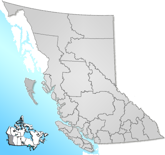
dot_mapsize = 220px
dot_map_caption = Location of Riondel inBritish Columbia
dot_x = 188 |dot_y = 176
pushpin_
pushpin_label_position =
pushpin_map_caption =
pushpin_mapsize =
subdivision_type = Country
subdivision_name = CAN
subdivision_type1 = Province
subdivision_name1 = BC
subdivision_type2 = Region
subdivision_name2 =Kootenays
subdivision_type3 = Regional district
subdivision_name3 = Central Kootenay
subdivision_type4 =
subdivision_name4 =
government_footnotes =
government_type =
leader_title = Governing body
leader_name = Riondel Commission of Management
leader_title1 = Mayor
leader_name1 = Don Howie
leader_title2 =
leader_name2 =
leader_title3 =
leader_name3 =
leader_title4 =
leader_name4 =
established_title = Founded
established_date = 1907
established_title2 =
established_date2 =
established_title3 =
established_date3 =
area_magnitude =
unit_pref =
area_footnotes =
area_total_km2 = 1.5
area_land_km2 =
area_water_km2 =
area_total_sq_mi =
area_land_sq_mi =
area_water_sq_mi =
area_water_percent =
area_urban_km2 =
area_urban_sq_mi =
area_metro_km2 =
area_metro_sq_mi =
area_blank1_title =
area_blank1_km2 =
area_blank1_sq_mi =
population_as_of = 2006
population_footnotes =
population_note =
population_total = 356
population_density_km2 =
population_density_sq_mi =
population_metro =
population_density_metro_km2 =
population_density_metro_sq_mi =
population_urban =
population_density_urban_km2 =
population_density_urban_sq_mi =
population_blank1_title =
population_blank1 =
population_density_blank1_km2 =
population_density_blank1_sq_mi =
timezone = PST
utc_offset = -8
timezone_DST =
utc_offset_DST =
latd= 49|latm= 45|lats= 49|latNS=N
longd= 116|longm= 51|longs= 23|longEW=W
elevation_footnotes =
elevation_m = 576
elevation_ft =
postal_code_type = Postal code span
postal_code = V0B
area_code =
blank_name = Highways
blank_info = 3A
blank1_name = Waterways
blank1_info =Kootenay Lake
website = [http://www.Riondel.ca Community of Riondel]
footnotes = Riondel is a village of approximately 400 people. It is situated on the eastern shore ofKootenay Lake , located 90-minutes fromNelson, British Columbia , using the world's longest freeferry ride.History
The settlement of riondel originated from a very productive
silver ,lead andzinc mine, know as theBluebell mine . In the 1882 an American namedRobert Sproule staked four claims along the RiondelPeninsula , including the Bluebell mine. When he left to register his claims an Englishman,Thomas Hammill , restaked the claims. This led to a dispute that ended with Sproule shooting Hammill dead and Sproule Dying in thegallows for his crime.1890s
In the 1890s the settlement was known as Hendryx, after
Wilbur Hendryx , who had control of the Bluebell mine and other claims in the mid 1880s. In 1905 The Canadian Metal Company purchased the mine, and in 1907 the settlement was named Riondel afterCount Edouard Riondel , the president of the Canadian Metal Company.Pronunciation
Riondel is pronounced in several different ways, even by locals: REE-on-del, RYE-on-del, and Ree-ON-dul are all commonly heard. However, S.S. Fowler, who applied for the post office in 1907, wrote: “It is or should be pronounced Ree-on-del with accent very slightly on the first syllable.”
Bluebell mine
The Bluebell mine operated from 1895 to 1929, during which the population of Riondel was stable at around 70 people. With the closure of the Bluebell mine in 1929 the population dwindled until in 1943 there were only 22 people left in Riondel. In 1950 the Bluebell mine re-opened, and the population of Riondel soared to almost 300 people within three years. The expansion of the Bluebell mine required more electricity and in 1952
Cominco built power lines across the Kootenay Lake, too bring power to the East Shore without the use of generators. Development included a smelter and a townsite. This mine has the longest history in the province ofBritish Columbia .1950-1972
From 1950, Riondel was a bustling, thriving mining town until 1972, when the Bluebell mine closed for good. Most people moved on to other near by towns, while the older employees stayed in Riondel and retired. Riondel became a popular retirement community and at one time had more seniors per capita than any other
postal code in Canada.1972-Present
Today Riondel is a tidy village with streets, lakeshore campground, beach, community centre, playground, cable TV system, 9-hole golf course, grocery and liquor store, cafe, pub, medical clinic, and in April, 2006 Riondel was connected with high-speed internet provided by
Telus . Currently about 400 people live in Riondel.Riondel Daze
On August 3, 4, and 5 Riondel hosts a celebration called Riondel Daze. This year Riondel celebrates their centennial 1907-2007. Riondel Daze is usually led by the historical society of Riondel's Vintage 1949 Mercury Ambulance.
Location
Riondel is located on Riondel Road on the eastern shore of Kootenay Lake, 6 miles (10 km) north of Kootenay Bay, the eastern terminal of the Kootenay Lake
ferry . Riondel is a 1-hour drive fromCreston, British Columbia , and a 90-minute drive fromNelson, British Columbia , using the world's longest free ferry ride.Hiking
The Waterfront Trail in Riondel follows 1.5 km of the lakeshore from the south end of North Bay beach; The Pebble Beach Trail 7 km north of Riondel leads from the Kootenay Lake East FS Road to a south-facing, pebbled beach; The 15-minute Pilot Bay Lighthouse Trail near Kootenay Bay leads to an historic 1907 lighthouse; The one-hour Pilot Bay Marine Park trail leads through varying terrain as it follows the lakeshore; The Plaid Lake Hiking Trail near Crawford Bay is a full day hike to the alpine Plaid Lake on the west side of the Purcell Mountains; The Duck Lakes Dykes Trail near Sirdar offers miles of almost level hiking through some of the richest
waterfowl habitat inBritish Columbia .Golf
Golfers in Riondel have two golf clubs to choose from; the 9-hole Par 3 course at the friendly Riondel Golf Club, located on Galena Bay Wharf Road just 10 minutes from the
Kootenay Bay ferry , and the 18-hole championship Kokanee Springs Golf Resort in Crawford Bay, a 20-minute drive to the south.Fishing
Kootenay Lake maintains considerable populations of various fish species, including kokanee, rainbow and
cutthroat trout ,Dolly Varden ,burbot , and whitefish. Kootenay Lake supports record-sizedRainbow Trout , and the world's largest recorded kokanee - almost 10 pounds (4.5 kg) - was taken from Kootenay Lake. 'Kokanee' means 'red fish' in the Kootenay Indian language and is the name given to the land-locked salmon that spawn in large numbers inKokanee Creek in the late summer. The best fishing time is in the fall and winter months.Recreation
Other outdoor opportunities in Riondel include
canoeing orkayaking the waters of the 75-mile long and 5-mile wide Kootenay Lake (rentals available), swimming, wildlife and nature viewing, boating and sailing, horsedrawn adventures, and backcountry exploration.Camping
The private Riondel Campground is located 1 km from the Riondel Market, and a second campground and
RV park is located 12 km north of Riondel.References
* [http://www.Riondel.ca Community of Riondel]
* [http://www.kootenaylake.bc.ca Kootenay Lake Region]
* [http://www.britishcolumbia.com British Columbia]
* [http://www.scope.telus.com/mediasol/riondel_segment/presentation/player.htm Telus]Further reading
* "Bluebell Memories" by A.Terry Turner
* "A Recollection of Moments: Riondel 1907-2007" by Wendy M E Scott
Wikimedia Foundation. 2010.