- Bieszczady County
Infobox Settlement
name = Bieszczady County
native_name = Powiat bieszczadzki
settlement_type = County
total_type = Total
image_shield =

image_shield =
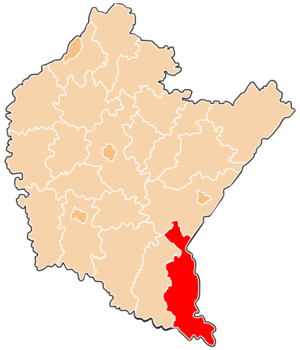
map_caption = Location within the voivodeship
subdivision_type = Country
subdivision_name = POL
subdivision_type1 = Voivodeship
subdivision_name1 = Subcarpathian
area_total_km2 = 1138.17
population_total = 22213
population_as_of = 2006
population_density_km2 = auto
population_urban = 9478
population_blank1_title = Rural
population_blank1 = 12735
coor_type = Ustrzyki Dolne
latd = 49
latm = 26
lats =
latNS = N
longd = 22
longm = 36
longs =
longEW = E
seat =Ustrzyki Dolne
parts_type =Gmina s
parts = Total 3
p1 = Gmina Czarna
p2 =Gmina Lutowiska
p3 =Gmina Ustrzyki Dolne
blank_name = Car plates
blank_info = RBI
website = http://www.bieszczadzki.pl/ __NOTOC__Bieszczady County ( _pl. powiat bieszczadzki) is a unit of territorial administration and local government (powiat ) inSubcarpathian Voivodeship , in the extreme south-east ofPoland , on the border withUkraine . It takes its name from the Bieszczady mountain range. The county was created onJanuary 1 ,1999 as a result of the Local Government Reorganization Act of 1998. In 2002 the western part of the county was split off to formLesko County . The only town in Bieszczady County is nowUstrzyki Dolne , the county seat, which lies convert|80|km|mi|0 south-east of the regional capitalRzeszów .The county covers an area of convert|1138.17|km2|sqmi|1. As of 2006 its total population is 22,213, out of which the population of Ustrzyki Dolne is 9,478 and the rural population is 12,735. Its average population density of 19.5 persons per square kilometre (50.5 per square mile) makes it the least densely populated county in Poland.
The county includes the greater part of
Bieszczady National Park ("Bieszczadzki Park Narodowy"), and of the Polish part of theUNESCO -designatedEast Carpathian Biosphere Reserve .Neighbouring counties
Bieszczady County is bordered by
Lesko County to the west andPrzemyśl County to the north. It also bordersUkraine to the east and south.Administrative division
The county is subdivided into three
gmina s (one urban-rural and two rural). These are listed in the following table, in descending order of population.References
* [http://www.stat.gov.pl/gus/45_655_PLK_HTML.htm Polish official population figures 2006]
Rural landscape picture
Wikimedia Foundation. 2010.