- Oregon Route 414
-
Oregon Route 414
Route information Maintained by ODOT Length: 0.91 mi (1.46 km) Existed: 2003 – present Major junctions West end: 
 OR 413 and OR 86 Spur in Halfway
East end: OR 86 near HalfwayHighway system Oregon highways
Routes • Highways← OR 413OR 422  →
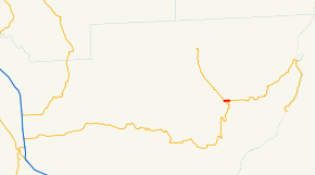
→Oregon Route 414 (OR 414) is an Oregon state highway running from OR 86 Spur and OR 413 in Halfway to OR 86 near Halfway. OR 153 is known as the Pine Creek Highway No. 414 (see Oregon highways and routes). It is 0.91 miles (1.46 km) long and runs east–west, entirely within Baker County.
OR 414 was established in 2003 as part of Oregon's project to assign route numbers to highways that previously were not assigned, and, as of July 2010, was unsigned.
Contents
Route description
OR 414 begins at an intersection with OR 86 Spur and OR 413 in Halfway heads east to an intersection with OR 86 approximately 3/4 mile east of the city limits, where it ends.
History
OR 414 was assigned to the Pine Creek Highway in 2003.
Major intersections
Milepost City Intersection 0.00 Halfway OR 86 Spur and OR 413 0.91 Near Halfway OR 86 See also
References
- Oregon Department of Transportation, Descriptions of US and Oregon Routes, http://www.oregon.gov/ODOT/HWY/TRAFFIC/TEOS_Publications/PDF/Descriptions_of_US_and_Oregon_Routes.pdf, page 31.
- Oregon Department of Transportation, Pine Creek Highway No. 414, ftp://ftp.odot.state.or.us/tdb/trandata/maps/slchart_pdfs_1980_to_2002/Hwy414_1974.pdf
Categories:- State routes in Oregon
- Transportation in Baker County, Oregon


Wikimedia Foundation. 2010.