- Nagarkot
-
This article is about the village in Nepal. For the Indian town historically known as Nagarkot, see Kangra, Himachal Pradesh.
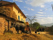
Nagarkot — Village Development Committee — Crops and houses on the hills of Nagarkot Location in Nepal Coordinates: 27°43′25″N 85°31′29″E / 27.7236°N 85.5247°ECoordinates: 27°43′25″N 85°31′29″E / 27.7236°N 85.5247°E Country  Nepal
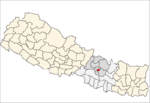
NepalZone Bagmati Zone District Bhaktapur District Population (1991) - Total 3,504 - Religions Hindu Time zone Nepal Time (UTC+5:45) Nagarkot is a village and Village Development Committee located 32 km east of Kathmandu, Nepal in Bhaktapur District in the Bagmati Zone. At the time of the 1991 Nepal census it had a population of 3,504 and had 655 houses in it.[1] At an elevation of 2,195 meters, it is considered one of the most scenic spots in Bhaktapur District. It is renowned for its sunrise view of the Himalaya including Mount Everest as well as other snow-capped peaks of the Himalayan range of eastern Nepal. Nagarkot also offers a panoramic view of the Kathmandu Valley.[2]
Nagarkot is an international tourist destination with spectacular views of the whole Langtang range, sunrise on the mountains and sunset views.[3]
References
- ^ "Peaceful Cottage & café du mont, Nagarkot Hillstation". Blogspot. http://www.nagarkothotels.blogspot.com. Retrieved 2008-08-26.
- ^ Lonely Planet Nepal, p. 224–225
- ^ The photos of Nagarkot Flickr.com
External links
 Categories:
- Geography of Nepal
- Populated places in Bhaktapur District
- Himalayas
Wikimedia Foundation. 2010.


