- Urmia Airport
-
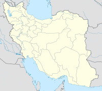
Urmia Airport IATA: OMH – ICAO: OITR Location of airport in Iran Summary Airport type Public / Military Operator Government Serves Urmieh, Iran Elevation AMSL 4,343 ft / 1,324 m Coordinates 37°40′05″N 045°04′07″E / 37.66806°N 45.06861°E Runways Direction Length Surface m ft 03/21 3,249 10,658 Asphalt Source: DAFIF[1][2] Urmia Airport (IATA: OMH, ICAO: OITR) is an airport in Urmia, a city in the West Azarbaijan Province of Iran. Alternate spellings of the city and airport name include Urmieh, Uromiyeh, Orumieh, and Orumiyeh.
Contents
Airlines and destinations
Airlines Destinations Iran Air Tehran-Mehrabad Iran Air Tours Tehran-Mehrabad Accidents and incidents
- On January 9, 2011, Iran Air Flight 277 crashed after a go-around was initiated during final approach in bad weather conditions, killing 77.
References
- ^ Airport information for OITR at World Aero Data. Data current as of October 2006.Source: DAFIF.
- ^ Airport information for OMH at Great Circle Mapper. Source: DAFIF (effective Oct. 2006).
External links
Categories:- Airports in Iran
- Asian airport stubs
- Iran transport stubs
- Iranian building and structure stubs
- West Azerbaijan Province geography stubs
Wikimedia Foundation. 2010.

