- Colindres
-
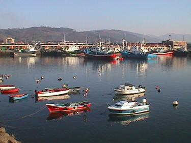
Colindres — Municipality — Ships in Colindres.
Coat of armsLocation of Colindres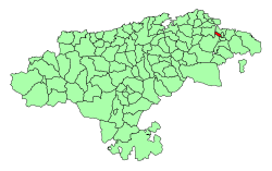 Location in Spain
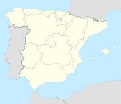
 Colindres
Coordinates: 43°23′48″N 3°26′54″W / 43.39667°N 3.44833°WCoordinates: 43°23′48″N 3°26′54″W / 43.39667°N 3.44833°W Country  Spain
SpainAutonomous community  Cantabria
Province Cantabria Comarca Eastern coast of Cantabria Judicial district Laredo Capital Colindres Government - Alcalde José Ángel Hierro (2007) (PSC-PSOE) Area - Total 5.94 km2 (2.3 sq mi) Elevation 10 m (33 ft) Highest elevation 281 m (922 ft) Lowest elevation 0 m (0 ft) Population (2008) - Total 7,677 - Density 1,292.4/km2 (3,347.4/sq mi) Demonym colindrés/esa, pejino/a Time zone CET (UTC+1) - Summer (DST) CEST (UTC+2) Postal code 39750 Official language(s) Website Official website Colindres is a town in the northern Spanish province and autonomous community of Cantabria. Located between the cities of Santander and Bilbao, Colindres has a population of approximately 7200.
Overview
In Colindres, the Asón River flows into the Cantabrian Sea forming, the Santoña estuary which is the most important SPA in the north of Spain, which is also known as the Santoña, Victoria and Joyel Marshes Natural Park, which Colindres is a part of. The town has the second fishing port in the region.
Its festivities during the summer are very popular in the region, and perhaps the most popular and the one which attracts the most people is the folk music festival SAUGA. Colindres' neighboring city, Laredo, has a long beach, La Salvé, with more than 5 km.
Sister cities
External links
 Media related to Colindres at Wikimedia Commons
- Ayuntamiento de Colindres
- SAUGA Folk
- Bienvenidos a Colindres – Pictures of Colindres (Spanish)
- Colindres - Cantabria 102 Municipios
- Paseando por Colindres
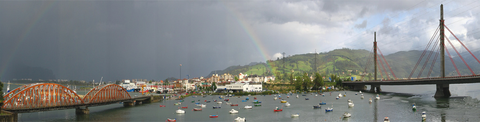 Panoramic view of Colindres' coast.
Municipalities of Cantabria Alfoz de Lloredo · Ampuero · Anievas · Arenas de Iguña · Argoños · Arnuero · Arredondo · El Astillero · Bárcena de Cicero · Bárcena de Pie de Concha · Bareyo · Cabezón de la Sal · Cabezón de Liébana · Cabuérniga · Camaleño · Carmago · Campoo de Enmedio · Campoo de Yuso · Cartes · Castañeda · Castro Urdiales · Cieza · Cillorigo de Liébana · Colindres · Comillas · Los Corrales de Buelna · Corvera de Toranzo · Entrambasaguas · Escalante · Guriezo · Hazas de Cesto · Hermandad de Campoo de Suso · Herrerías · Lamasón · Laredo · Liendo · Liérganes · Limpias · Luena · Marina de Cudeyo · Mazcuerras · Medio Cudeyo · Meruelo · Miengo · Miera · Molledo · Noja · Penagos · Peñarrubia · Pesaguero · Pesquera · Piélagos · Polaciones · Polanco · Potes · Puente Viesgo · Ramales de la Victoria · Rasines · Reinosa · Reocín · Ribamontán al Mar · Ribamontán al Monte · Rionansa · Riotuerto · Las Rozas de Valdearroyo · Ruente · Ruesga · Ruiloba · San Felices de Buelna · San Miguel de Aguayo · San Pedro del Romeral · San Roque de Riomiera · San Vicente de la Barquera · Santa Cruz de Bezana · Santa María de Cayón · Santander · Santillana del Mar · Santiurde de Reinosa · Santiurde de Toranzo · Santoña · Saro · Selaya · Soba · Solórzano · Suances · Los Tojos · Torrelavega · Tresviso · Tudanca · Udías · Val de San Vicente · Valdáliga · Valdeolea · Valdeprado del Río · Valderredible · Valle de Villaverde · Vega de Liébana · Vega de Pas · Villacarriedo · Villaescusa · Villafufre · Voto

This article related to Cantabria, Spain is a stub. You can help Wikipedia by expanding it.