- Askeaton
Infobox Irish Place
name = Askeaton
gaeilge = Eas Géitine
crest
motto =
map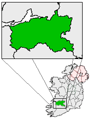
pin coords = left: 52px; top: 44px
north coord = 52.6001
west coord = 8.9772
irish grid = R337503
area =
county =County Limerick
population =
census yr = 2006
province =Munster
web =
|Askeaton ("Eas Géitine" in Irish) is a town in
County Limerick ,Ireland . Located on the N69, the town is built on the banks of theRiver Deel some 3 km upstream from the estuary of theRiver Shannon .Among the many historic structures in the town are a
Franciscan Friary dating from 1389 and a castle dating from 1199. The castle was abandoned to crown forces in 1580 - its walls blown up by the fleeing Spanish defenders - after the fall of Carrigafoyle Castle to the English during theDesmond Rebellions .Transport
The railway line that passes through the now closed Askeaton railway station was built by the former
Limerick and Foynes Railway Company from 1856 to 1858, with the station opening on 12 May 1857.cite web | title=Askeaton station | work=Railscot - Irish Railways | url=http://www.railscot.co.uk/Ireland/Irish_railways.pdf | accessdate=2007-09-08] The line betweenLimerick andFoynes had stations at Patrickswell, Kilgobbin, Adare, Ballingrane Junction (Rathkeale) and Askeaton. The railway line toFoynes passes north of the town, but [http://www.industrialheritageireland.info/railways/foynes/askeatonphotos.htm Askeaton Railway Station] was closed to passenger traffic on 4 February 1963 and freight on 2 December 1974, when the station closed. Trains for Foynes continued to pass through Askeaton until the line effectively lost all its freight services in 2000. The line is still officially open to freight traffic, it has not seen a train since the annual weedspray train visited the line in May 2002.ee also
* List of towns in Ireland
External links
* [http://www.franciscans.ie/161.0.html Information on the friary]
* [http://www.askeatonbynet.com/ Askeaton community web-site]References
Wikimedia Foundation. 2010.