- Cuencamé, Durango
-
Coordinates: 24°52′N 103°42′W / 24.867°N 103.7°W
Cuencamé 
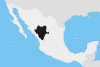
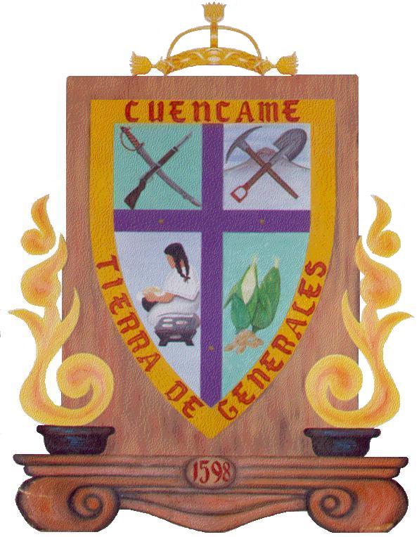
Coat of armsNickname(s): Land of Generals Location in Mexico
 Cuencamé
Coordinates: 24°52′12″N 103°41′45″W / 24.87°N 103.69583°W Country  Mexico
State Durango Founded Late 16th century Government – Mayor Eligio Moreno Martínez
(Coalition "Durango Nos Une"|)Elevation 1,580 m (5,184 ft) Population (2005) – Total 9,520 – Demonym Cuencamense Time zone Central Standard Time (UTC-6) – Summer (DST) Central Daylight Time (UTC-5) Website http://www.cuencame.com.mx Cuencamé is a small city and seat of the municipality of Cuencamé in the state of Durango, which is in northern Mexico. Cuencamé was founded by the Spaniards around the 1890s. Towns near this city include Ocuila, Pasaje, Cerro Gordo, Pedriceña and Velardeña. Cuencame has been in existence at least since the late 16th century.
Contents
City
Cuencamé originally was a very small town formed by a joining wild northern tribes. During the colonial period different groups settled in there, as the Zacatecos, Tepehuanos and Laguneros. This place was located in the central arid area and attracted a lot of people interested in the silver mines around Cuencamé.
Important residents
At the beginning in the colonial period, there was a prior a priest Agustín de Espinoza.
Another Jesuit priest was Jerónimo Ramírez who came there in August 1594. Another famous name is a monk Francisco Santos who had under his control the monastery of Cuencamé named Saint Anthony. Another outstanding person is Carlos Michaud who founded the village of Pedriceña, who was named the captain of Pedriza in the colonial period.
In the Mexican revolution period Calixto Contreras (1867–1918) and Severino Ceniceros (1880–1937) were notable people. They were born in the borough of Cuencame.[1]The municipality
History
It is “a wide valley around by beautiful mountains according by words of father Jeronimo Ramirez Jesuit priest who came to this place in August 1594. This father was working a lot in this place and he had heading a colonizing project. A letter from Rodrigo de Paz explains that Captain martin de Zapata arrived cuencame and that before him were presented the caciques from Manganapa, Salina and Rio of Nazas they were the ones who took the name of the Captain and they received lands for their settlement. In 1622 was mentioned the monastery of Cuencame's Saint Anthony the was by control of Friar Francis Santos. Afterwards the name was modified by monetary of Purisima Concepción. May be to distinguish from other in Durango.[1] Any way the Franciscans arrived this place in 1583, although it is possible that they abandoned the region in latter time. This place had a lot of mines in the region around. The mine of Terneras caused the installation of the plant property of American Smelting and Refining Company, which exhausted its silver veins.
Geography
Location
The township is located in the western area of the state. By the shape and the extension it's one of he most big in the state. The limits in the north are the followings places: the township of Nazas and Lerdo. To the East its limits are with townships of Simon Bolivar and Santa Clara. To the West adjoin with townships of Poanas, Guadalupe Victoria and Peñon Blanco. To the South limits with Zacatecas State.[2] Inside the municipality we find the community of Pedriceña, founded by Carlos Michaud taking the name of the Captain Pedroza who distinguished himself during the colonial epoch. It was nearly considered an independent municipality.
The geographical coordinates are: 24º 52’ North latitude and 103º42’ West latitude. The distance from the main capital of state is 146 km. The high of the township is 1,580 meters up sea level.
Natural geography
Climate
Cuencamé, Durango Climate chart (explanation) J F M A M J J A S O N D 1225752782311173214173517513518883218101321765311623301310281010258Average max. and min. temperatures in °C Precipitation totals in mm Source: [1] Imperial conversion J F M A M J J A S O N D 0.576440.281460.187510.390570.79562294653.59064490632.688610.986560.482500.47646Average max. and min. temperatures in °F Precipitation totals in inches The area is semiarid. The ground is flat and surrounded by mountains. The average temperature is around 21.5°C. The annual rainfall is 392.1 millimeters.[3]
Mountains
To the township North lies the San Lorenzo mountain. Between these mountains lie the main state highway and the railroad to Torreón, Coahuila. In this area there is the Huarichic Canyon. These mountains spread until the Lerdo township. And the name of this Mountains is “Sierra Fernández”.[2]
In this chain of the mountains lies a San Isidro peak that is a wall of this chain of the mountains. In these mountains lie the Velardeña's valley and its mines. There are rural and steep mountains as a Guadalupe mountains that lies and combine the area landscape with Jimulco and Simon Bolivar, both of the Coahuila, state. These two mountains Guadalupe and Jimulco shape the most wide canyon of this area, between them it spreads the Aguanaval river and the state railroad. The name of this mountain is “Jimulco Canyon”. The Aguanaval River flows into the Nazas River, which is the main river in this area. The surrounding area to this mountains is arid and easy to watch the Cretaceous formation of the plates and layers of the ground.
Rivers, lakes, and springs
The main river in this area is the Cuencamé stream. All of the rivers in this area arrive to the Cuencamé stream. There are many small streams that in the rainy season are plenty of water. There is another stream near to San Pedro Ocuila and other named the “Arrieras”. In the recent years many of these streams have decreased substantially. The Cuencamé stream runs into the Nazas River in the point named Rancho de Fernández. In the 50's they were built two dams to keep the mountains water in the area. These dams have had helping to the agriculture needs in this north area.
References
Notes
- ^ a b "Municipios de Durango". http://www.durango.gob.mx/plantillas/info_municipios.php?op=tipo&id=6&it=Historia. Retrieved 2008-08-25.
- ^ a b "Enciclopedia de los Municipios de México". http://www.e-local.gob.mx/work/templates/enciclo/durango/index.html. Retrieved 2008-08-25.
- ^ "Normales Climatológicas 1971-2000". Archived from the original on 2008-05-03. http://web.archive.org/web/20080503080733/http://smn.cna.gob.mx/productos/normales/estacion/dgo/NORMAL10012.TXT. Retrieved 2008-08-25.
Municipalities
and
(municipal seats)Canatlán (Ciudad Canatlán) · Canelas (Canelas) · Coneto de Comfort (Coneto de Comonfort) · Cuencamé (Cuencamé de Ceniceros) · Durango (Victoria de Durango) · El Oro (Santa María del Oro) · General Simón Bolívar (General Simón Bolívar) · Gómez Palacio (Gómez Palacio) · Guadalupe Victoria (Ciudad Guadalupe Victoria) · Guanaceví (Guanaceví) · Hidalgo (Villa Hidalgo) · Indé (Indé) · Lerdo (Ciudad Lerdo) · Mapimí (Mapimí) · Mezquital (San Francisco del Mezquital) · Nazas (Nazas) · Nombre de Dios (Nombre de Dios) · Nuevo Ideal (Nuevo Ideal) · Ocampo (Villa Ocampo) · Otáez (Otáez) · Pánuco de Coronado (Francisco I. Madero) · Peñón Blanco (Peñón Blanco) · Poanas (Villa Unión) · Pueblo Nuevo (El Salto) · Rodeo (Rodeo) · San Bernardo (San Bernardo) · San Dimas (Tayoltita) · San Juan de Guadalupe (San Juan de Guadalupe) · San Juan del Río (San Juan del Río) · San Luis del Cordero (San Luis del Cordero) · San Pedro del Gallo (San Pedro del Gallo) · Santa Clara (Santa Clara) · Santiago Papasquiaro (Santiago Papasquiaro) · Súchil (Súchil) · Tamazula (Tamazula de Victoria) · Tepehuanes (Santa Catarina de Tepehuanes) · Tlahualilo (Tlahualilo de Zaragoza) · Topia (Topia) · Vicente Guerrero (Vicente Guerrero)
 Categories:
- Wikipedia articles needing cleanup after translation
- Populated places in Durango


Wikimedia Foundation. 2010.