- Malakal Airport
-
Malakal Airport IATA: MAK – ICAO: HSSM Location of Malakal Airport in South Sudan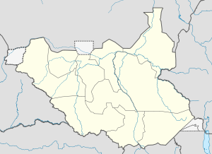
 MAK
MAKSummary Airport type Public, Civilian Owner Civil Aviation Authority of South Sudan Serves Malakal, South Sudan Location Malakal,  South Sudan
Elevation AMSL 1,291 ft / 393.5 m Coordinates 09°33′54″N 031°39′36″E / 9.565°N 31.66°E Runways Direction Length Surface ft m 05/23 6,562 2,000 Asphalt Malakal Airport (IATA: MAK, ICAO: HSSM) is an airport in Malakal, South Sudan.
Contents
Location
Malakal Airport, (IATA: MAK, ICAO: HSSM), is located in Malakal County in Upper Nile State, in the city of Malakal, near the International border with the Republic of Sudan and the border with Ethiopia. The airport is located just north of the city's central business district, adjacent to the main campus of Upper Nile University.
This location lies approximately 521 kilometres (324 mi), by air, north of Juba International Airport, the largest airport in South Sudan.[1] The geographic coordinates of this airport are: 9° 33' 54.00"N, 31° 39' 36.00"E (Latitude: 9.5650; Longitude: 31.6600).
Malakal Airport sits at an elevation of 393.5 metres (1,291 ft) above sea level.[2] The airport has a single, unlit, asphalt runway, measuring 2,000 metres (6,600 ft) in length.[3]
Overview
Malakal Airport is the second-largest airport in South Sudan. It one of the two International airports in the country, the other being Juba International Airport, in the capital city of Juba, South Sudan. Malakal Airport serves the city of Malakal and the surrounding communities.
As part of the United Nation's Mission to Sudan (UNMIS), the airport was a major staging point for United Nation operations to South Sudan and will continue to do so under the new United Nation's Mission to South Sudan (UNMISS) mandate.[4]
Scheduled airlines and destinations
The following airlines maintain scheduled service at Malakal Airport to the following destinations:
Airlines Destinations Ethiopian Airlines Addis Ababa, Juba Feeder Airlines Khartoum, Juba Marsland Aviation Khartoum Southern Star Airlines Juba Sudan Airways Khartoum Photos
External links
See also
- Malakal
- Upper Nile State
- Greater Upper Nile
- List of airports in South Sudan
References
Coordinates: 9°33′54″N 31°39′36″E / 9.5650°N 31.6600°E
Airports in South SudanCategories:- Malakal
- Airports in South Sudan
- Upper Nile (state)
- Greater Upper Nile

Wikimedia Foundation. 2010.