- Petawawa River
Geobox River
name = Petawawa River
native_name =
other_name =
other_name1 =

image_size = 300px
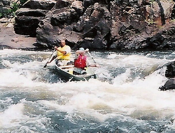
image_caption = "The dangerous Crooked Chute in Algonquin Park"
etymology =
country =Canada flagicon|Canada
country1 =
state =Ontario flagicon|Ontario
state1 =
region =
region1 =
district =
district1 =
city =
city1 =
landmark =
landmark1 =
length =
watershed =
discharge_location =
discharge =
discharge_max =
discharge_min =
discharge1_location =
discharge1 =
source_name =
source_location =
source_district =
source_region =Algonquin Provincial Park
source_state =Ontario flagicon|Ontario
source_country =Canada flagicon|Canada
source_lat_d =
source_lat_m =
source_lat_s =
source_lat_NS =
source_long_d =
source_long_m =
source_long_s =
source_long_EW =
source_elevation =
source_length =
source1_name =
source1_location =
source1_district =
source1_region =
source1_state =
source1_country =
source1_lat_d =
source1_lat_m =
source1_lat_s =
source1_lat_NS =
source1_long_d =
source1_long_m =
source1_long_s =
source1_long_EW =
source1_elevation =
source1_length =
source_confluence_location =
source_confluence_district =
source_confluence_region =
source_confluence_state =
source_confluence_country =
source_confluence_lat_d =
source_confluence_lat_m =
source_confluence_lat_s =
source_confluence_lat_NS =
source_confluence_long_d =
source_confluence_long_m =
source_confluence_long_s =
source_confluence_long_EW =
source_confluence_elevation =
mouth_name =
mouth_location =
mouth_district =
mouth_region =
mouth_state =Ontario flagicon|Ontario
mouth_country =Canada flagicon|Canada
mouth_lat_d =
mouth_lat_m =
mouth_lat_s =
mouth_lat_NS =
mouth_long_d =
mouth_long_m =
mouth_long_s =
mouth_long_EW =
mouth_elevation =
tributary_left =
tributary_left1 =
tributary_right =
tributary_right1 =
free_name =
free_value =
map_size =
map_caption =The Petawawa River is a
river in easternOntario ,Canada .It starts at Butt Lake in northern
Algonquin Park and flows east, emptying into theOttawa River at the Town of Petawawa. The river is km to mi|187 in length and drains an area of km2 to mi2|4200|precision=-2, with a mean discharge of 45 m³/s (source: Atlas of Canada).The river's name comes from the
Algonquian language, meaning "where one hears a noise like this", which refers to its many rapids. From the late 1800s until the 1960s, the river was used forlog driving of thetimber from the forested areas surrounding the river. The river is popular amongcanoe ing andkayak ing enthusiasts for itswhite water rapids and often spectacular views.Part of the Petawawa River lies in the
Ottawa-Bonnechere Graben which is a 175 million year oldrift valley .Tributaries of this river include:
* Barron River
* Crow River
*Little Madawaska River
*Nipissing River
* North River
Wikimedia Foundation. 2010.
