Orapa Airport

Orapa Airport
Orapa Airport
IATA: ORPICAO: FBOR
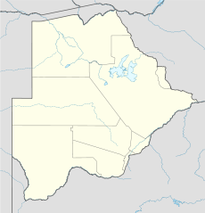
Orapa is located in Botswana
{{{alt}}}
Orapa
Location of airport in Botswana
Summary
Airport type Private
Owner Debswana
Location Orapa, Botswana
Elevation AMSL 3,100 ft / 945 m
Coordinates 21°16′02″S 025°19′04″E / 21.26722°S 25.31778°E / -21.26722; 25.31778Coordinates: 21°16′02″S 025°19′04″E / 21.26722°S 25.31778°E / -21.26722; 25.31778
Website www.dca.gov.bw/...
Runways
Direction Length Surface
m ft
07/25 1,675 5,495 Bitumen
Source: Department of Civil Aviation[1]

Orapa Airport (IATA: ORPICAO: FBOR)[2] is an private airport in Orapa,[1] a town located in the Central District of Botswana. It is owned by Debswana,[1] which also owns the Orapa diamond mine.

There is no scheduled airline service. Landing permission has to be obtained from Debswana at least 48 hours prior to arrival. Customs and immigration services can also be arranged, provided that transport for the officials to and from the airport is provided.

Facilities

The airport resides at an elevation of 3,100 feet (945 m) above mean sea level. It has one runway designated 07/25 with a bitumen surface measuring 1,675 by 25 metres (5,495 × 82 ft). The runway handles aircraft with MAUW of up to 7,980 kilograms (17,600 lb).[1]

References

  1. ^ a b c d Airports: Orapa. Botswana Department of Civil Aviation.
  2. ^ Airport information for ORP / FBOR at Great Circle Mapper.

External links


Wikimedia Foundation. 2010.

Игры ⚽ Поможем решить контрольную работу

Look at other dictionaries:

  • Orapa — Coordinates: 21°20′02″S 25°21′53″E / 21.33389°S 25.36472°E / 21.33389; 25.36472 …   Wikipedia

  • Gaborone —   City   From top to bottom: skyline view of Gaborone, statue of Seretse Khama, the city centre of Gaborone, bird s eye view of Gaborone …   Wikipedia

  • Botswana — /bot swah neuh/, n. a republic in S Africa: formerly a British protectorate; gained independence 1966; member of the Commonwealth of Nations. 1,500,765; 275,000 sq. mi. (712,250 sq. km). Cap.: Gaborone. Formerly, Bechuanaland. * * * Botswana… …   Universalium

  • List of Botswana-related topics — This is a list of topics related to Botswana. Those interested in the subject can monitor changes to the pages by clicking on Related changes in the sidebar. Botswana * Botswana * Botswana Railways * Botswana diplomatic missions * Sankuyo… …   Wikipedia

  • Liste der IATA-Codes/O — IATA Codes aller größeren internationalen Flughäfen. IATA Codes   A B C D E F G H I J …   Deutsch Wikipedia

  • Liste Des Codes AITA Des Aéroports/O — Liste des codes AITA des aéroports internationaux. Le code de deux lettres qui suit la ville est la subdivision du pays (région, État…) selon la norme ISO 3166 2. Liste des codes AITA des aéroports : A B C D E F G H I J K L M N O P Q R S T …   Wikipédia en Français

  • Liste des codes AITA des aeroports/O — Liste des codes AITA des aéroports/O Liste des codes AITA des aéroports internationaux. Le code de deux lettres qui suit la ville est la subdivision du pays (région, État…) selon la norme ISO 3166 2. Liste des codes AITA des aéroports : A B… …   Wikipédia en Français

  • Liste des codes AITA des aéroports/O — Liste des codes AITA des aéroports internationaux. Le code de deux lettres qui suit la ville est la subdivision du pays (région, État…) selon la norme ISO 3166 2. Liste des codes AITA des aéroports : A B C D E F G H I J K L M N O P Q R S T …   Wikipédia en Français

  • Liste des codes aita des aéroports/o — Liste des codes AITA des aéroports internationaux. Le code de deux lettres qui suit la ville est la subdivision du pays (région, État…) selon la norme ISO 3166 2. Liste des codes AITA des aéroports : A B C D E F G H I J K L M N O P Q R S T …   Wikipédia en Français

  • Maun — from the air in 2007 Location of Maun in Botswana …   Wikipedia

Share the article and excerpts

Direct link
Do a right-click on the link above
and select “Copy Link”