- Mbanza Congo Airport
-
Mbanza Congo Airport
M'banza Congo AirportIATA: SSY – ICAO: FNBC Location of Airport in Angola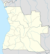
 SSY
SSYSummary Airport type Public Operator Government Location Mbanza Congo, Angola Elevation AMSL 1,860 ft / 567 m Coordinates 06°16′11″S 014°14′49″E / 6.26972°S 14.24694°E Runways Direction Length Surface ft m 16/34 5,905 1,800 Asphalt Source: DAFIF[1][2] Mbanza Congo Airport or M'banza Congo Airport (IATA: SSY, ICAO: FNBC) is an airport serving Mbanza Congo (also known as M'banza Congo or M'banza-Kongo) in northwestern Angola.
Airlines and destinations
Airlines Destinations TAAG Angola Airlines Luanda, Negage, Soyo References
- ^ Airport information for FNBC at World Aero Data. Data current as of October 2006.Source: DAFIF.
- ^ Airport information for SSY at Great Circle Mapper. Source: DAFIF (effective Oct. 2006).
External links
Categories:- Airports in Angola
- Central Africa airport stubs
- Angola stubs

Wikimedia Foundation. 2010.