- Musick Point
-
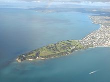 Musick Point from the air.
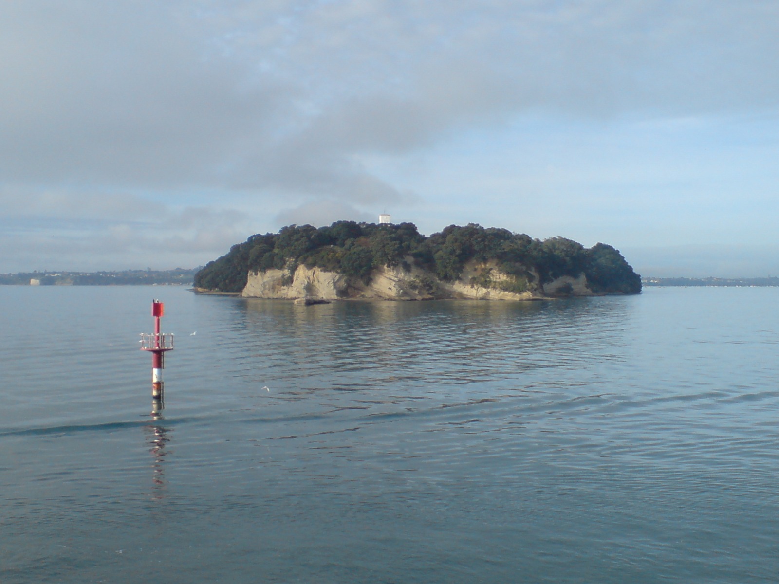
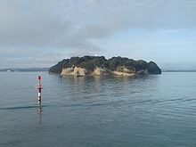 Musick Point from the north.
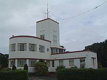 The radio station building.
Musick Point is the headland of the peninsula that forms the eastern shore of the Tamaki River in Bucklands Beach, a suburb of Manukau City in New Zealand.[1] In 1942 Musick Point was named after Ed Musick, a famous aviator,who visited NZ in 1937.,[2] although the headland is also known as Te Waiarohia, after an ancient Māori stronghold. Today it is occupied by a golf club and a disused radio station.
The peninsula itself (known as Te Naupata in Māori)[3] terminates between the Motukorea Channel and the Tamaki Strait in the Waitemata Harbour, Auckland. The residential areas of Bucklands Beach and Eastern Beach lie immediately to the south.
History
The headland was originally used by Māori of the Ngai Tai iwi (tribe), who dug a ditch across the peninsula as part of Te Waiarohia Pā, until it was overrun by the neighbouring Ngapuhi iwi in 1821.[3] Parts of the ditch are still clearly visible. The beaches and the sea were plentiful sources of food for the local population.[2]
In 1836, 40,000 acres (160 km2), including the point, were bought by William Thomas Fairburn, a missionary, for 90 blankets, 24 adzes, 24 hoes, 14 spades, 80 Pounds (money), 900 lb (410 kg) of tobacco, 24 combs, and 12 plain irons.[4] The land was later parcelled up and sold on.[2] During the early settlers era it was called East Head.
Today it is a favorite spot for walking,wedding photos, sightseeing over the harbour and for recreational fishing, as well as being the site of a golf course.[1]
Radio station
Musick Point has long been the site of a radio station. In 1942, a government radio station started operation, the point having been considered an ideal location for the communication technology which had become increasingly important to communicate with ships and aircraft. The station was operated by the New Zealand Post Office before the Air Radio was taken over by Civil Aviation Corporation, with the NZPO handling all the maritime services. Later, ownership changed to Telecom NZ Ltd for maritime service, now Telecom Corporation NZ, which is today using the building for provision of cellular services.[2]
During World War II, a secondary radio bunker was built 300m to the south in case the main station was bombed from the air.[2] Because the area was isolated a water tower was built to store water for the small group of houses and the single workers accomadation that was built at the same time as the station, about 500m to the south of the main radio building.
References
- ^ a b "Fishing: Thank you for the Musick". Herald on Sunday. 23 January 2005. http://www.nzherald.co.nz/section/4/story.cfm?c_id=4&objectid=10007654. Retrieved 27 October 2011.
- ^ a b c d e Musick Point - Early History (from the New Zealand Association of Radio Transmitters (NZART) website. Retrieved 2007-10-02.)
- ^ a b Manukau Council webpage
- ^ Deed No.347 - Auckland District Vii Records (private land purchases), 23 January 1836
Coordinates: 36°50′50″S 174°54′05″E / 36.847208°S 174.901357°E
Categories:- New Zealand radio
- Geography of Auckland
- Auckland Region geography stubs

Wikimedia Foundation. 2010.