Monte Ceneri Pass

Monte Ceneri Pass
Monte Ceneri Pass

Monte Ceneri Pass
Elevation 554 m (1,818 ft)
Location
Location  Switzerland
Range Alps
Coordinates 46°8′21″N 8°54′24″E / 46.13917°N 8.90667°E / 46.13917; 8.90667Coordinates: 46°8′21″N 8°54′24″E / 46.13917°N 8.90667°E / 46.13917; 8.90667

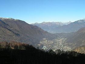
Monte Ceneri Pass (el. 554 m.) is a mountain pass in the Alps in the canton of Ticino in Switzerland.

It connects the Magadino plain and the Vedeggio valley.

Two tunnels have been dug under the Monte Ceneri, a road tunnel for the A2 motrway and a railway tunnel. A new Ceneri Base Tunnel is currently under construction that will connect Camorino near Bellinzona and Vezia near Lugano.

See also

References

This article incorporates information from the German Wikipedia.

See also


Wikimedia Foundation. 2010.

Игры ⚽ Поможем написать реферат

Look at other dictionaries:

  • Monte Ceneri transmitter — The Monte Ceneri transmitter is the nationwide transmitter for Italian speaking Switzerland, working on 558 kHz, located on Monte Ceneri in Ticino, Switzerland. Contents 1 1933 tower 2 1978 mast 3 Italian transmitter …   Wikipedia

  • Landessender Monte Ceneri — Der filigrane Sendemast (1978) ist aus Distanz kaum sichtbar. Der Landessender Monte Ceneri war der auf der Mittelwellenfrequenz 558 kHz mit einer Sendeleistung von 300 kW betriebene Landessender für die italienischsprachige Schweiz. Von 1933 bis …   Deutsch Wikipedia

  • Monte — Contents 1 Persons 1.1 Surname 1.2 Given name 2 Places …   Wikipedia

  • Ceneri — Monte Ceneri Kanton/Land: Tessin von nach: Cadenazzo Lugano Passhöhe: 554 m ü. M …   Deutsch Wikipedia

  • Monte Tamaro — pd5 Monte Tamaro Monte Tamaro von Osten, rechts die Mündung des Flusses Ticino in den …   Deutsch Wikipedia

  • Ceneri Base Tunnel — The Ceneri Base Tunnel (CBT) is a railway tunnel under construction in Switzerland s Canton Ticino. The tunnel will pass under Monte Ceneri between Camorino in the Magadino Flat and Vezia near Lugano. This tunnel is another part of the Swiss… …   Wikipedia

  • Pass dal Fuorn — Vorlage:Infobox Pass/Wartung/Profil fehlt Ofenpass Blick vom Ofenpass in den Schweizerischen Nationalpark …   Deutsch Wikipedia

  • Gotthard-Pass — Gotthardpass Kanton/Land: Uri, Tessin von nach: Andermatt – Airolo Passhöhe: 2 091 m ü. M …   Deutsch Wikipedia

  • Sankt-Gotthard-Pass — Gotthardpass Kanton/Land: Uri, Tessin von nach: Andermatt – Airolo Passhöhe: 2 091 m ü. M …   Deutsch Wikipedia

  • Sankt Gotthard (Pass) — Gotthardpass Kanton/Land: Uri, Tessin von nach: Andermatt – Airolo Passhöhe: 2 091 m ü. M …   Deutsch Wikipedia

Share the article and excerpts

Direct link
Do a right-click on the link above
and select “Copy Link”