- Spaarne
Geobox River
name = Spaarne
native_name =
other_name =
other_name1 =
image_size = 240px
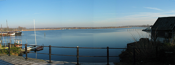
image_caption = Mouth of the Spaarne
country = Netherlands
country1 =
state = North Holland
state1 =
region =
region1 =
district =
district1 =
city =
city1 =
length = 10.5
watershed =
discharge_location =
discharge_average =
discharge_max =
discharge_min =
discharge1_location =
discharge1_average =
source_name = Ringvaart
source_location = Cruquius
source_district =
source_region =
source_state =
source_country =
source_lat_d =
source_lat_m =
source_lat_s =
source_lat_NS =
source_long_d =
source_long_m =
source_long_s =
source_long_EW =
source_elevation =
source_length =
mouth_name = North Sea Canal
mouth_location = Spaarndam
mouth_district =
mouth_region =
mouth_state =
mouth_country =
mouth_lat_d =
mouth_lat_m =
mouth_lat_s =
mouth_lat_NS =
mouth_long_d =
mouth_long_m =
mouth_long_s =
mouth_long_EW =
mouth_elevation =
tributary_left =
tributary_left1 =
tributary_right = De Liede
tributary_right1 =
free_name =
free_value =
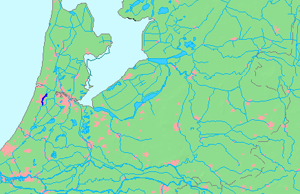
map_size = 240px
map_caption = Location of the Spaarne in dark blue.The Spaarne is ariver , inNorth Holland ,the Netherlands . This partially canalized river connects theRingvaart to a side branch of theNorth Sea Canal . It runs throughHeemstede ,Haarlem , andSpaarndam .The historic canals of Haarlem's moats are connected to the Spaarne. A lock at
Spaarndam separates it from the North Sea Canal.According to Sterck-Proot, a historican, the name Spaarne probably comes from "Spier", which means reed in old Dutch.
History
The river formerly flowed from the
Haarlemmermeer (Haarlem Lake) to the IJ Bay, which used to extend from theZuiderzee all the way toVelsen . In the 13th century, a dam with locks were constructed at the mouth of the Spaarne where the village of Spaarndam then formed.After a century of planning, Haarlem's Lake was pumped dry in 3 years from 1850-1853 and made into a
polder . The Spaarne became a branch of the Ringvaart, lost much of its flow, and became shallower.The construction of the North Sea Canal (completed in 1876) reduced most of the IJ Bay into polders but a small canalized section of the IJ remained at Spaarndam to connect the Spaarne to the new canal.
The river was deepened for the benefit of industries along its shores.
Places of interest along the riverbanks
* At the juncture of the river and the Ringvaart is the
Cruquius Museum , a museum that resides in one of the three original pumping stations from 1850.Steam engine s were used to pump the water out from the Haarlemmermeer polder.
*Castle Heemstede
*Many historic buildings in the centre of Haarlem, including:
**The Weigh House of Haarlem
**Teylers Museum
**Teylers Hofje
**Windmill s "De Hommel", and "De Adriaan ".References
* J.M Sterck-Proot, Tjeenk Willink, "Haarlems oudste tijden: een vroeg-middeleeuwsch stadsbeeld", Haarlem, 1930.
*Bert Sliggers a.o., "De loop van het Spaarne; de geschiedenis van een rivier", Haarlem, Schuyt, 1987.
Wikimedia Foundation. 2010.