Chingford — Coordinates: 51°37′52″N 0°00′58″E / 51.631°N 0.016°E / 51.631; 0.016 … Wikipedia
Lee Valley Reservoir Chain — are located in the Lee Valley,and comprise of 13 reservoirs which supply drinking water to London [ [http://paginas.fe.up.pt/ mjneves/publicacoes files/data/es/ponencias/por autor/pdf/10109.pdf Reservoir information] Retrieved November 09,2007] … Wikipedia
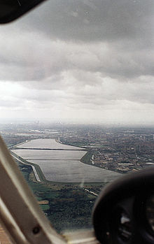
William Girling Reservoir — Infobox lake lake name = William Girling Reservoir image lake = William Girling Reservoir.jpg caption lake = The reservoir viewed from Chingford image bathymetry = caption bathymetry = location = London Borough of Enfield coords =… … Wikipedia
King George V Reservoir — Infobox lake lake name = King George V Reservoir image lake = King George V Reservoir.jpg caption lake = Looking west across reservoir image bathymetry = caption bathymetry = location = London Borough of Enfield coords =… … Wikipedia
Enfield parks and open spaces — The London Borough of Enfield is the northernmost of the Outer London boroughs. The borough lies on the London Green Belt, and several of its 127+ parks and open spaces are part of it. The ancient Enfield Chase, remnants of which still exist,… … Wikipedia
River Lee Diversion — is located in the Lee Valley close to Enfield Lock and to the north east corner of the King George V Reservoir. History As its name implies the River Lee was diverted to accommodate the construction of the Chingford Reservoirs and the Banbury… … Wikipedia
London Borough of Waltham Forest — Infobox London Borough | status = London borough name = London Borough of Waltham Forest short name = Waltham Forest imagename = area rank = 323rd area km2 = 38.82 ons code = 00BH | adminhq = Walthamstow ethnicity = 64.5% White 15.4% African… … Wikipedia
Waltham Forest — /wawl teuhm, theuhm/ a borough of Greater London, England. 228,200. * * * ▪ borough, London, United Kingdom outer borough of London. It lies on the northeastern perimeter of the metropolis, adjoining the Green Belt, and is bounded on the… … Universalium
River Lee (England) — Geobox River name = Lee/Lea map size = map caption = other name = other name1 = country = United Kingdom country1 = region = region1 = city = city1 = length = 68 length imperial = watershed = watershed imperial = discharge location = discharge… … Wikipedia
Hampstead — For other places with the same name, see Hampstead (disambiguation). Coordinates: 51°33′15″N 0°10′28″W / 51.5541°N 0.1744°W / 51.5541; … Wikipedia
 Looking south over the twin basins of the King George V Reservoir and the William Girling Reservoir in background
