- Dukono
-
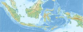
Dukono Halmahera, Indonesia Elevation 1,335 m (4,380 ft) [1] Location Coordinates 1°41′N 127°53′E / 1.683°N 127.883°ECoordinates: 1°41′N 127°53′E / 1.683°N 127.883°E[1] Geology Type Complex volcano Last eruption 2011 (continuing) Dukono is a volcano located at the northernmost corner of Halmahera island. It has a broad profile and is capped by compound craters. Dukono is an active volcano. During the major eruption in 1550, a lava flow filled in the strait between Halmahera and the north flank cone of Mount Mamuya.[1] It was an eruption of scale 3 on VEI. Deaths were reported but the figure is unknown. Smaller eruptions occurred in 1719, 1868, and 1901.[2] Since 1933, Dukono has been erupting continuously until the present.[1]
See also
References
- ^ a b c d "Dukono". Global Volcanism Program, Smithsonian Institution. http://www.volcano.si.edu/world/volcano.cfm?vnum=0608-01=. Retrieved 2006-12-13.
- ^ "Dukono, Halmahera Arc Volcanoes, Indonesia". Volcano World. Archived from the original on 2008-06-16. http://web.archive.org/web/20080616090800/http://volcano.und.edu/vwdocs/current_volcs/dukono/dukono.html. Retrieved 2010-09-01.
Categories:- Complex volcanoes
- Mountains of Indonesia
- Active volcanoes of Indonesia
- Volcanoes of Halmahera
- Maluku Islands and New Guinea (Indonesia) geography stubs
Wikimedia Foundation. 2010.

