- Farm to Market Road 1
Infobox TX State Highway
type=Farm
route=1
length_mi=18.6
length_ref=cite web|url=http://www.dot.state.tx.us/tpp/hwy/fm/fm0001.htm|author=Texas Department of Transportation |title=Highway Designation File - Farm to Market Road No. 1|accessdate=2006-12-04]
length_round=1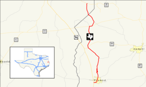
formed=1941
dir1=South
dir2=North
from=
junction=
to=
previous_type=Ranch
previous_route=1
next_type=Farm
next_route=2Farm to Market Road 1, or FM 1, is a
farm-to-market road , a state maintained road which serves to connect rural and agricultural areas to market towns, in theU.S. state ofTexas . The road was the first farm-to-market road to be designated in Texas at the request of local industry for a paved road. The convert|18.6|mi|km|sing=on road provides access to rural areas ofEast Texas from U.S. Highway 96.History
The road was designated on April 23, 1941, the first Farm to Market Road to be designated in Texas. It was designated shortly after it was upgraded from a dirt road to a paved road at the request of The Temple Lumber Company and two gas companies.cite web|url=http://www.zwire.com/site/index.cfm?newsid=17268425|title=FM 1 in East Texas piney woods is the original country road|author=Krift, F.A.|date=2006-10-01|accessdate=2006-12-06|publisher=
The Beaumont Enterprise ] It wasn't until eight years later that legilation to establish the farm-to-market road system was passed. FM 1 originally ran from Pineland northward to Magasco from its inception in 1941 until 1954 when FM 1776 was cancelled and combined with FM 1. Throughout its history the road has predominantly served the logging industry.Route description
FM 1 begins in southwestern Sabine County near Pineland at a junction with U.S. Highway 96. In Pineland, FM 1 is known as Temple Avenue and travels eastward and then northward through the town. North of Pineland, the roads name changes to Magasco Drive as it travels northward to the town of Magasco. Just south of Magasco, FM 1 has a short spur that travels on the west side of the
BNSF Railway tracks as the main road crosses the tracks and parallels the spur to the east of the tracks.cite map|url=http://maps.google.com/maps?f=d&hl=en&geocode=5547960634770962350,31.240630,-93.984870%3B17416285139660088275,31.244230,-93.975318%3B2775657923335151923,31.250707,-93.973416%3B14643639590097522713,31.314704,-93.969410%3B10017237191704737470,31.346660,-94.001760%3B3396246541044265224,31.349370,-94.002320%3B14481888013266508566,31.412437,-93.998123%3B15540279749542648151,31.414138,-93.989602%3B15017229010242362850,31.427853,-93.984491&saddr=FM-1%2FS+Temple+Ave+%4031.240630,+-93.984870&daddr=FM-1%2FS+Temple+Ave+%4031.244230,+-93.975318+to:FM-1%2FTemple+Ave+%4031.250707,+-93.973416+to:FM-1%2FTemple+Rd+N+%4031.314704,+-93.969410+to:FM-1%2FTemple+Rd+N+%4031.346660,+-94.001760+to:FM-1%2FTX-184+%4031.349370,+-94.002320+to:Bronson+Rd%2FFM-1+%4031.412437,+-93.998123+to:FM-1%2FTX-103+%4031.414138,+-93.989602+to:FM-1%2FRosevine+Rd+%4031.427853,+-93.984491+to:31.48235,-94.005139&mra=mi&mrcr=8&mrsp=9&sz=16&sll=31.480923,-94.007607&sspn=0.01195,0.014527&ie=UTF8&ll=31.378262,-93.99971&spn=0.382802,0.464859&z=11&om=0|title=Overview Map of FM 1|publisher=Google Maps |accessdate=2008-02-06]FM 1 continues northward through Sabine County then turns to a more northwesterly route after its junction with FM 2024. FM 1 is know as North Temple Road as it enters the town of Bronson. A short break occurs in the road as it intersects SH 184 in Bronson. FM 1 begins again at a point farther north on SH 184 and heads north as Bronson Road.
FM 1 heads north from Bronson until it intersects with SH 103 west of Rosevine. At this point another break in the road occurs. FM 1 begins again at a point farther east along SH 103. The road heads to the northeast and is known as Rosevine Road. The road changes course to the north-northwest after a junction with FM 1592. FM 1 leaves Sabine County northwest of Rosevine. Only a couple of miles of FM 1 exist in San Augustine County. The road enters the northeastern portion of the county heading north until it terminates at State Highway 21 at Fords Corner.
Junction List
External links
* [http://markhancock.blogspot.com/2006/10/texas-fm-1.html Photos of FM 1]
References

Wikimedia Foundation. 2010.