- Fujimi, Gunma
Japanese city
Name = Fujimi
JapaneseName = 富士見村
Prefecture =Gunma Prefecture
Region = Kantō
Area_km2 = 70.42
Population = 22,267
PopDate =September 1 ,2007
Density_km2 = 316.20
Coords = coord|36|27|N|139|5|E|region:JP_type:city
Postal code =
Area code =
Mayor =
Tree =
Flower =
Bird =
Symbol
CityHallPostalCode = 371-0192
CityHallAddress = Fujimi-mura, 240 Ōaza Tajima
CityHallPhone = 027-288-2211
CityHallLink = [http://www.vill.fujimi.gunma.jp/ Fujimi Village]
City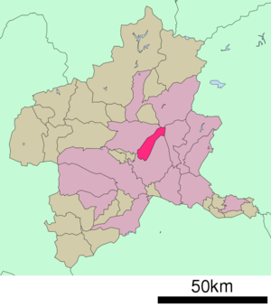
Elevation =nihongo|Fujimi|富士見村|Fujimi-mura is a village located in Seta District, Gunma,
Japan .As of
September 1 ,2007 , the village has an estimatedpopulation of 22,267 and a density of 316.20 persons per km². The total area is 70.42 km².History
*A planned merger of municipalities will be implemented on
May 5 ,2009 ; Fujimi will merge into the city of Maebashi. Seta District will cease to exist.http://www.kokudo.or.jp/new/cities/sub/kanto/10.htm]Geography
Located in the northwestern portion of the
Kantō Plain , the village stretches from the summit ofMount Akagi to the bottom. At the summit of Mount Akagi, there are two lakes, Ōnuma and Konuma,caldera lakes.Alpine plants such as Asian skunk cabbages grow in themarshland . The northern portion of the village is mainly covered by forests without many human dwellings, while the southern portion is flat, where there are many farmlands. It is currently the fourth populous village in Japan.urrounding municipalities
*
Gunma Prefecture
** Maebashi
** Kiryū
** Numata
** ShibukawaEducation
*
Primary Schools
** Hara Elementary School
** Ishii Elementary School
** Shirokawa Elementary School
** Tokizawa Elementary School
*Junior High Schools
** Fujimi Junior High SchoolReferences
External links
*ja icon [http://www.vill.fujimi.gunma.jp/ Fujimi official website]

Wikimedia Foundation. 2010.