- Shibukawa, Gunma
Japanese city
Name = Shibukawa
JapaneseName = 渋川市
Region = Kantō
Prefecture =Gunma Prefecture
District =
Area_km2 = 240.42
Population = 86,395
PopDate = 2008
Density_km2 = 359
Coords= coord|36|29|N|139|0|E|region:JP_type:city
Latitude = 36°29' N
Elevation =
Tree =
Flower =
Bird =
Symbol
Map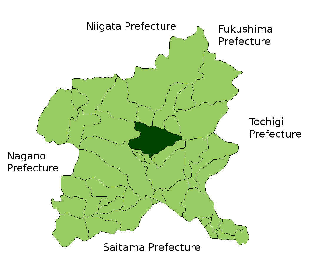
Mayor =
CityHallPostalCode = 377-8501
CityHallAddress = 80 Ishihara, Shibukawa-shi, Gunma-ken
CityHallPhone = 0279-22-2111
CityHallLink = http://www.city.shibukawa.gunma.jp/index.html
City
ExtraNotes =nihongo|Shibukawa|渋川市|Shibukawa-shi is a city located in the extreme northwest of the Kantō Plain, in the center of landlocked Gunma,
Japan . Encompassing the juncture of theTone River andAgatsuma River , it is about 120km fromTokyo . Due to its location at the geographical center of the nation, Shibukawa is known as the Bellybutton of Japan (日本のおへそ, "nihon no oheso").Shibukawa originally grew to prosperity as an inn town, but even today is in a central location between Numata and Maebashi. Also, anyone going to a number of famous hot spring resorts, such as Kusatsu, Shima, or Ikaho must pass through Shibukawa.
As of April 2008, the city had a
population of 86,395 and a density of 359 persons per km². The total land area is 240.42 km².The city was founded on
April 1 ,1954 .Geography
Shibukawa is located at a central point (36°29′ N, 139°00′ E) of the
Japanese Archipelago and is thus known as the Bellybutton of Japan (日本のおへそ, "nihon no oheso"). The city encompasses an area of 240.42 km².To the west is
Mt. Haruna , and to the east isMt. Akagi . To the north areMt. Onoko andMt. Komochi . TheTone River flows from the north (betweenMt. Akagi andMt. Komochi ) southward through the city, while theAgatsuma River flows from the west (betweenMt. Onoko andMt. Haruna ), merging with theTone River near the center of the city.Shibukawa's highest altitude is 1,565m above
sea level ; its lowest point is 139m above sea level. The majority of the city lies between 200 and 800 meters above sea level.Farmland covers 49.88km² (20.8% of the city), housing covers 20.31km² (8.4%), and mountains and forests cover 77.39km² (32.2%). The remaining 92.84km² (38.6%) has other land uses.
Adjacent Cities, Towns, and Villages
To the north: Numata City, Showa Village, Takayama Village
To the east: Fujimi Village
To the south: Maebashi City, Shinto Village, Yoshioka Town
To the west: Takasaki City, Higashi Agatsuma Town, Nakanojo Town
History
*Shibukawa developed as an inn town on the old
Mikuni Road .
*In 1889, Shibukawa Village became Shibukawa Town.
*On April 1, 1954, Furumaki Village, Kanashima Village, Shibukawa Town, and Toyoaki Village merged to form Shibukawa City.
*On February 20, 2006, Ikaho Town, Akagi Village, Kitatachibana Village, Komochi Village, and Onogami Village merged together with Shibukawa City.Demagraphics
Shibukawa's population, as of April 2008, was 86,395. There were 42,313 males and 44,082 females. The number of households was 30,870. The population density was 359 persons per km².
ister cities
Foligno inUmbria ,Italy is Shibukawa's sister city.Logan City, Queensland ,Australia is designated as a Friendship City with Shibukawa.In the spring of 2008, high school students from Shibukawa visited their counterparts in
Chico, California .Festivals
Shibukawa calls itself "The Bellybutton of Japan" (日本のおへそ) and hosts the
Bellybutton Festival (へそ祭り ) every year in late July. One of the most famous events in this festival is the parade of people with their bellies painted like faces.Transportation
Rail
*
East Japan Railway Company
**Joetsu Line (Yagihara Station ,Shibukawa Station ,Shikishima Station , andTsukuda Station )
**Agatsuma Line (Shibukawa Station ,Kanashima Station ,Ubashima Station ,Onogami Station , andOnogami Onsen Station )Roads
*Expressway
**Kan-Etsu Expressway (Shibukawa-Ikaho Interchange ,Akagi Interchange )
*National Highways
**National Route 17
**National Route 353chools
Shibukawa has four high schools:
*Shibukawa High School
*Shibukawa Girls' High School
*Shibukawa Kougyou High School
*Shibukawa Seisui High SchoolThere are ten junior high schools:
*Akagi North Junior High School
*Akagi South Junior High School
*Furumaki Junior High School
*Hokkitsu Junior High School
*Ikaho Junior High School
*Kanashima Junior High School
*Komochi Junior High School
*Shibukawa Junior High School
*Shibukawa North Junior High School
*Onogami Junior High School.Finally, there are seventeen elementary schools:
*Ikaho Elementary School
*Furumaki Elementary School
*Kamishiroi Elementary School
*Kanashima Elementary School
*Miharada Elementary School
*Nagaou Elementary School
*Nagumo Elementary School
*Nakagou Elementary School
*Onogami Elementary School
*Shibukawa North Elementary School
*Shibukawa South Elementary School
*Shibukawa West Elementary School
*Tachibana North Elementary School
*Tachibana South Elementary School
*Tousen Elementary School
*Toyoaki Elementary School
*Tsukuda Elementary SchoolAttractions
* [http://www5.wind.ne.jp/skyland/ Shibukawa Skyland Park] - an amusement park
* [http://www.greenbokujo.co.jp/index1.html/ Ikaho Green Bokujou] - a farm designed to show it's customers various things about farming
*Ikaho Sistina Museum- an op art museum which also has a Sistine Chapel replica
*Japan Chanson Museum- a museum dedicated to thechanson style of music
*Shibukawa Sougou Park- a large park encompassing hiking trails, campsites, tennis courts, a baseball diamond, a running track, and various other recreational facilities
*Onoike Ajisai Park- a hydrangea park with a pond and hiking trails
* [http://www8.wind.ne.jp/skyterume/ Shibukawa Sky Terume] - a hot spring in a building which looks something like a spaceshipTrivia
Shibukawa is the home town of the main character in
Initial D . Many scenes of the live action movie were taped on location in Shibukawa.References
*cite web | title="市内小・中学校リンク集" | work=Shibukawa City Official Site | url=http://www.city.shibukawa.gunma.jp/hyakka/link_gakko.html | date=2006-07 | accessdate=2006-08-29 (Japanese)
*cite web | title="合併の変遷" | work=Shibukawa City Official Site | url=http://www.city.shibukawa.gunma.jp/aramasi/hensen.html | date=2006-06 | accessdate=2006-06-16 (Japanese)
*cite web | title="渋川市の統計" | work=Shibukawa City Official Site | url=http://www.city.shibukawa.gunma.jp/aramasi/toukei/01toki.html | date=2006-06 | accessdate=2006-06-16 (Japanese)
*cite web | title="渋川市の地勢と気候" | work=Shibukawa City Official Site | url=http://www.city.shibukawa.gunma.jp/aramasi/tisei_kikou.html | date=2006-06 | accessdate=2008-05-28 (Japanese)
*cite web | title="MapionBB" | work=MapionBB | url=http://www.mapion.co.jp/c/f?uc=1&grp=MapionBB&scl=500000&el=139/03/51.236&nl=36/23/16.939 | date=2006-08 | accessdate=2006-08-29 (Japanese)
*cite web | title="渋川市住民基本台帳人口/渋川市" | work=Shibukawa City Official Site | url=http://www.city.shibukawa.gunma.jp/osirase/jinkou/jinkou.html | date=2008-04 | accessdate=2008-05-28 (Japanese)* Gullick, Chris. "Japanese students say goodbye to Chico students" nl.newsbank.com/nl-search/we/Archives?p_product=CERB&p_theme=cerb&p_action=search&p_maxdocs=200&s_dispstring=allfields(Shibukawa)%20(%20Japan)%20AND%20date(2008)&p_field_date-0=YMD_date&p_params_date-0=date:B,E&p_text_date-0=2008&p_field_advanced-0=&p_text_advanced-0=("Shibukawa")%20("%20Japan")&p_perpage=10&p_sort=YMD_date:D&xcal_useweights=no.html. "Chico Enterprise Record", April 4, 2008. Retrieved May 5, 2008.
External links
* [http://www.city.shibukawa.gunma.jp/ Shibukawa official website] in Japanese.
Wikimedia Foundation. 2010.