Omokoroa

Omokoroa
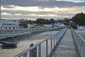
The sun setting at the Omokoroa wharf

Omokoroa is a small urban area in the Western Bay of Plenty District of New Zealand. The suburb is considered part of Greater Tauranga, (contributing towards its population of 120,000), but is actually within the Coromandel Electorate. Omokoroa started off as a small rural holiday village, but has recently expanded to a commuter town, with a 15 minute drive to Tauranga City since the expansion of feeder roads, ready for the Tauranga Northern Motorway. This method of building roads before the people, not for the people, is a pioneering concept which is designed to dictate special growth areas. Omokoroa is expected to reach a population of 12,500 by 2020, and is the largest town in Kaimai Ward, WBOPDC.

Omokoroa includes the urban area on the harbour side of State Highway 2, along with Youngson Road to Plummers Point Road, and parts of Old Highway Road.

Contents

Communication

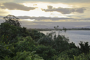
The sun setting over Omokoroa

The postcodes for the area are:

  • 3114 (Railway line to harbours edge)
  • 3172 (All other areas as defined above)[1]

The dialing prefix(es) for the town are

  • (+64) 7 548

Education

The local schools in the area are Omokoroa Point School and Omokoroa No. 1, and the nearest zoned secondary school in the area is Otumoetai College. Some students attend Tauranga City Colleges, but changes in school zoning have restricted the possibility of this for future year groups. Other options include Katikati College, a small country school of 1000(approximate) pupils.

Shopping

The closest shopping to the town is the Bethlehem Town Centre.

Coordinates: 37°40′S 176°02′E / 37.667°S 176.033°E / -37.667; 176.033

References


Wikimedia Foundation. 2010.

Игры ⚽ Поможем сделать НИР

Look at other dictionaries:

  • Omokoroa Thermal Holiday Park — (Omokoroa Beach,Новая Зеландия) Категория отеля: 4 звездочный отель Адрес: 165 O …   Каталог отелей

  • Tauranga Harbour — Blick von Mount Maunganui nach Süden, der Tauranga Harbour mit einem Teil der Hafenanlagen liegt rechts …   Deutsch Wikipedia

  • Bay of Plenty — The Bay of Plenty ( mi. Te Moana a Toi), often abbreviated to BoP, is a region in the North Island of New Zealand situated around the body of water of the same name. The bay was named by James Cook after he noticed the abundant food supplies at… …   Wikipedia

  • List of towns in New Zealand — This is a list of towns in New Zealand. The term town has no current statutory meaning in New Zealand, the few Town Districts having been abolished in 1989 or earlier. No particular size minimum has been adopted. Many would be called villages in… …   Wikipedia

  • Urban areas of New Zealand — Statistics New Zealand defines New Zealand urban areas for statistical purposes. The urban areas comprise cities, towns and other conurbations (an aggregation or continuous network of urban communities) of a thousand people or more. In… …   Wikipedia

  • Eric Petrie — Infobox Historic Cricketer nationality = New Zealand country = New Zealand country abbrev = NZ name = Eric Petrie picture = Cricket no pic.png batting style = Right hand bat bowling style = Legbreak tests = 14 test runs = 258 test bat avg = 12.90 …   Wikipedia

  • Bay of Plenty Times — Infobox Newspaper name = Bay of Plenty Times caption = type = Daily/Evening (except Sunday) Newspaper format = Broadsheet foundation = 1872 owners = APN News Media editor = Craig Nicholson circulation = 24,038 [http://www.pmca.co.nz/var/cm/cm… …   Wikipedia

  • Matakana Island — Lage von Matakana Island Matakana Island ist eine Insel im Westen der Bay of Plenty auf der Nordinsel von Neuseeland. Inhaltsverzeichnis 1 Geografie …   Deutsch Wikipedia

  • Liste der Ortschaften in Neuseeland — Die Liste der Ortschaften Neuseelands umfasst alle Ortschaften Neuseelands. Die Liste ist aufgeteilt in Städtelisten und eine alphabetische Liste aller Ortschaften. Städtelisten Der Begriff ‚Stadt‘ (englisch city/town) wird in Neuseeland… …   Deutsch Wikipedia

Share the article and excerpts

Direct link
Do a right-click on the link above
and select “Copy Link”