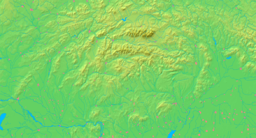
- Malachov
-
Malachov Village Country Slovakia Region Banská Bystrica District Banská Bystrica Elevation 505 m (1,657 ft) Coordinates 48°43′N 19°05′E / 48.717°N 19.083°E Area 6.40 km2 (2.5 sq mi) Population 918 (2004-12-31) Density 143 / km2 (370 / sq mi) First mentioned 1327 Mayor Slivka Ondrej Postal code 974 05 Area code +421-48 Car plate BB Statistics: MOŠ/MIS Malachov is a village and municipality in Banská Bystrica District in the Banská Bystrica Region of central Slovakia.
History
In historical records the village was first mentioned in 1327.
Geography
The municipality lies at an altitude of 505 metres and covers an area of 6.266km². It has a population of about 918 people.
External links
Banská Bystrica
Badín · Baláže · Brusno · Čerín · Dolná Mičiná · Dolný Harmanec · Donovaly · Dúbravica · Harmanec · Hiadeľ · Horná Mičiná · Horné Pršany · Hrochoť · Hronsek · Kordíky · Králiky · Kynceľová · Lučatín · Ľubietová · Malachov · Medzibrod · Moštenica · Motyčky · Môlča · Nemce · Oravce · Podkonice · Pohronský Bukovec · Poniky · Povrazník · Priechod · Riečka · Sebedín-Bečov · Selce · Slovenská Ľupča · Staré Hory · Strelníky · Špania Dolina · Tajov · Turecká · Vlkanová Categories:
- Villages and municipalities in Banská Bystrica District
- Banská Bystrica Region geography stubs
Wikimedia Foundation. 2010.


