- Chonma
-
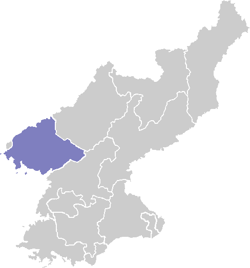
Chonma Chosŏn'gŭl 천마군 Hancha 天摩郡 McCune–Reischauer Ch'ŏnma kun Revised Romanization Cheonma-gun Statistics Area 763.3 km2 (294.7 sq mi) Population 33,000 [1] Population density 43.2/km2 (112/sq mi) Administrative divisions 1 ŭp, 1 workers' districts, 20 ri Chonma is a kun, or county, in northwestern North Pyongan province, North Korea. It borders Kusong and Taegwan to the east, Sonchon and Tongrim to the south, Uiju and Pihyon to the west, and Sakchu to the north. It was created in 1952 from parts of Kusong and Uiju.
There are abundant mountains, with the Chonma and Munsu ranges both traversing the county. The highest peak is Chonmasan, 1169 m. The Chonmasan region provides habitat for a variety of animals, and has been designated an animal protection area.
The county lies in the Yalu River basin; major tributaries draining the county include the Samgyochon and the Kojin and Chonma Rivers; these have been dammed to create Manpung Lake as well as the Taeha Reservoir, the water from which is used to water the plains along the Yellow Sea.
The climate is continental, with hot summers and cold winters. The average annual temperature is 8.7 °C, with a January average of -10.7 °C and an August average of 22.6 °C. The average annual rainfall is 1260 mm. Some 13% of the county's land is cultivated; 82% is forestland. Chonma leads the province in the production of hops.
Contents
Notes
- ^ According to the Dusan and Korean Britannica online encyclopedias.
References
- International Information Research Institute (국제정보연구소) (1999). "천마군". 北韓情報總覽 2000 [Bukhan jeongbo chong-ram 2000]. Seoul: Author. pp. 826–827.
See also
External links
- (Korean) In Korean language online encyclopedias:
North P'yŏngan Capital 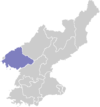
Cities Counties Categories:- Counties of North Pyongan
Wikimedia Foundation. 2010.