- Kwail
Infobox Korean settlement
context = north
hangul = 과일군
hanja =
rr = Gwail-gun
mr = Kwail kun
divs = 1 "p", 22 "ri"
area_km2 = 374
pop = 65200
popyear = 1988
popnote = (est.)
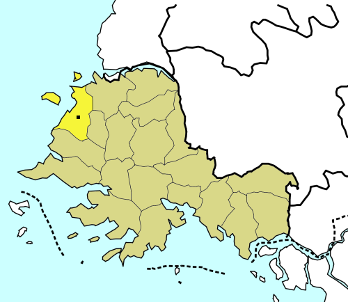
mapcaption = Location of Kwail in South HwanghaeKwail is a "kun", or county, in
South Hwanghae province,North Korea . It faces theYellow Sea to the west.The economy of the county is based on the production of fruit. Kwail County was created in 1967 from part of
Songhwa County, with the intention of making the entire cultivated area of the county into "100 li of blooming orchards". The name "Kwail" is a Korean word meaning "fruit," and doesn't correspond to anyChinese characters . This makes Kwail County one of the few counties in Korea whose name cannot be written inhanja ; for another such county, see Saebyŏl.ee also
*
Geography of North Korea
*Administrative divisions of North Korea
*South Hwanghae External links
*baekgwa|empas_b=114494|empas_k=267635|naver=17440|nate=10952700|
Wikimedia Foundation. 2010.